Area Overview for SM6 9PX
Photos of SM6 9PX
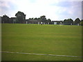
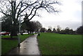
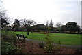
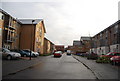
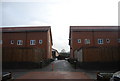
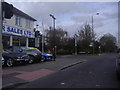

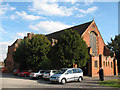
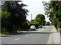

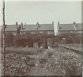
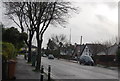
77 photos from this area
Area Information
Key information about the SM6 9PX including its size, population, and administrative classification.
- Area Type
- Postcode
- Area Size
- 6742 m²
- Population
- 1617
- Population Density
- 7037 people/km²
House Prices in SM6 9PX
28
Properties
£417,179
Average Sold Price
£127,000
Lowest Price
£827,000
Highest Price
Showing 28 properties
| Address | Type | Beds | Baths | Last Sale Price | Last Sale Date | |
|---|---|---|---|---|---|---|
| 91 Onslow Gardens, Wallington, SM6 9PX | Maisonette | 2 | 1 | £345,000 | Oct 2024 | |
| 107 Onslow Gardens, Wallington, SM6 9PX | Semi-detached | 4 | 2 | £827,000 | Mar 2024 | |
| 109 Onslow Gardens, Wallington, SM6 9PX | Retail | 4 | 1 | £815,000 | Mar 2023 | |
| 89 Onslow Gardens, Wallington, SM6 9PX | Retail | 5 | 1 | £827,000 | Oct 2022 | |
| 91A Onslow Gardens, Wallington, SM6 9PX | Maisonette | 2 | 1 | £390,000 | Sep 2021 | |
| 97A Onslow Gardens, Wallington, SM6 9PX | Flat | 3 | 1 | £322,000 | Nov 2020 | |
| 95 Onslow Gardens, Wallington, SM6 9PX | Maisonette | 2 | 1 | £350,000 | Jun 2020 | |
| 87A Onslow Gardens, Wallington, SM6 9PX | Maisonette | 2 | 1 | £348,000 | Jan 2020 | |
| 95A Onslow Gardens, Wallington, SM6 9PX | Maisonette | 4 | 2 | £362,000 | Sep 2019 | |
| 99 Onslow Gardens, Wallington, SM6 9PX | house | - | - | £290,000 | Sep 2015 |
Page 1 of 3
Energy Efficiency in SM6 9PX
Amenities
Schools
| Rank | School | Type | Entry gender | Ages |
|---|
Explore more schools in this area
Go to Schools tabDemographics
Household Size
Family (3-5 people)
most common
Accommodation Type
Houses
most common
Tenure
81
majority
Ethnic Group
White
most common
Religion
N/A
most common
Household Composition
N/A
most common
Age
47
median
Adults (30-64 years)
most common
Household Deprivation
N/A
with no deprivation
NS-SEC
48
in Lower managerial occupations
Explore more demographic insights in this area
Go to Demographics tabPlanning
Planning Constraints
- Flood RiskPremium
- Ramsar Wetland SitesPremium
- Area of Outstanding Natural BeautyPremium
- Protected Nature ReservePremium
- Protected WoodlandPremium