Area Overview for SM6 8DX
Photos of SM6 8DX
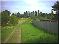
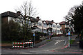
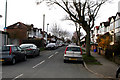
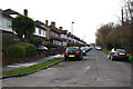
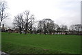
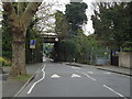
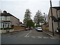
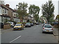
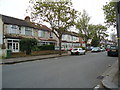
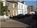
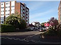

47 photos from this area
Area Information
Key information about the SM6 8DX including its size, population, and administrative classification.
- Area Type
- Postcode
- Area Size
- 2.9 hectares
- Population
- 1630
- Population Density
- 475 people/km²
House Prices in SM6 8DX
66
Properties
£350,974
Average Sold Price
£12,500
Lowest Price
£695,000
Highest Price
Showing 66 properties
| Address | Type | Beds | Baths | Last Sale Price | Last Sale Date | |
|---|---|---|---|---|---|---|
| 25 Rectory Lane, Wallington, SM6 8DX | Terraced | 3 | 1 | £550,000 | Sep 2025 | |
| 20 Rectory Lane, Wallington, SM6 8DX | Terraced | 3 | 2 | £395,000 | Jul 2024 | |
| Mapleleaf, Rectory Lane, Wallington, SM6 8DX | Bungalow | 3 | 1 | £650,000 | Sep 2023 | |
| 46 Rectory Lane, Wallington, SM6 8DX | Detached | 3 | 2 | £695,000 | Jun 2023 | |
| 15 Rectory Lane, Wallington, SM6 8DX | Terraced | 3 | 1 | £500,000 | Nov 2022 | |
| 32 Rectory Lane, Wallington, SM6 8DX | house | - | - | £484,000 | Mar 2022 | |
| 31 Rectory Lane, Wallington, SM6 8DX | Maisonette | - | - | £275,000 | Aug 2021 | |
| Avonlea, Rectory Lane, Wallington, SM6 8DX | Bungalow | 2 | - | £420,000 | Nov 2020 | |
| Oakwood, Rectory Lane, Wallington, SM6 8DX | Bungalow | 2 | 1 | £462,000 | Sep 2020 | |
| 31A Rectory Lane, Wallington, SM6 8DX | Flat | - | - | £12,500 | Apr 2020 |
Page 1 of 7
Energy Efficiency in SM6 8DX
Amenities
Schools
| Rank | School | Type | Entry gender | Ages |
|---|
Explore more schools in this area
Go to Schools tabDemographics
Household Size
Family (3-5 people)
most common
Accommodation Type
Houses
most common
Tenure
65
majority
Ethnic Group
White
most common
Religion
N/A
most common
Household Composition
N/A
most common
Age
47
median
Adults (30-64 years)
most common
Household Deprivation
N/A
with no deprivation
NS-SEC
31
in Lower managerial occupations
Explore more demographic insights in this area
Go to Demographics tabPlanning
Planning Constraints
- Flood RiskPremium
- Ramsar Wetland SitesPremium
- Area of Outstanding Natural BeautyPremium
- Protected Nature ReservePremium
- Protected WoodlandPremium