Area Overview for SM6 7JD
Photos of SM6 7JD
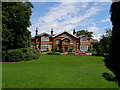
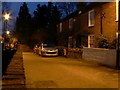
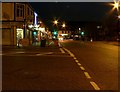
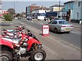
100 photos from this area
Area Information
Key information about the SM6 7JD including its size, population, and administrative classification.
- Area Type
- Postcode
- Area Size
- 1.0 hectares
- Population
- 1609
- Population Density
- 4376 people/km²
House Prices in SM6 7JD
31
Properties
£318,210
Average Sold Price
£80,000
Lowest Price
£625,000
Highest Price
Showing 31 properties
| Address | Type | Beds | Baths | Last Sale Price | Last Sale Date | |
|---|---|---|---|---|---|---|
| Flat Above, 8 Butter Hill, Wallington, SM6 7JD | Flat | 2 | 1 | £380,000 | Aug 2023 | |
| 44 Butter Hill, Wallington, SM6 7JD | Semi-detached | 4 | 2 | £625,000 | Apr 2023 | |
| 16 Butter Hill, Wallington, SM6 7JD | Flat | 2 | 1 | £355,000 | Apr 2023 | |
| 30 Butter Hill, Wallington, SM6 7JD | Retail | 3 | - | £605,000 | Sep 2022 | |
| 16A Butter Hill, Wallington, SM6 7JD | Maisonette | 2 | 2 | £279,000 | Oct 2021 | |
| 50 Butter Hill, Wallington, SM6 7JD | house | - | - | £501,250 | Nov 2020 | |
| 34 Butter Hill, Wallington, SM6 7JD | house | - | - | £486,000 | Sep 2020 | |
| 24 Butter Hill, Wallington, SM6 7JD | Semi-detached | 3 | 1 | £395,000 | Sep 2019 | |
| 26 Butter Hill, Wallington, SM6 7JD | Detached | 3 | 1 | £450,000 | Sep 2019 | |
| 38 Butter Hill, Wallington, SM6 7JD | Semi-detached | 3 | 1 | £390,000 | May 2019 |
Page 1 of 4
Energy Efficiency in SM6 7JD
Amenities
Schools
| Rank | School | Type | Entry gender | Ages |
|---|
Explore more schools in this area
Go to Schools tabDemographics
Household Size
Family (3-5 people)
most common
Accommodation Type
Houses
most common
Tenure
81
majority
Ethnic Group
White
most common
Religion
N/A
most common
Household Composition
N/A
most common
Age
47
median
Adults (30-64 years)
most common
Household Deprivation
N/A
with no deprivation
NS-SEC
41
in Lower managerial occupations
Explore more demographic insights in this area
Go to Demographics tabPlanning
Planning Constraints
- Flood RiskPremium
- Ramsar Wetland SitesPremium
- Area of Outstanding Natural BeautyPremium
- Protected Nature ReservePremium
- Protected WoodlandPremium