Area Overview for SM6 0SB
Photos of SM6 0SB
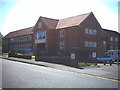
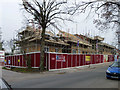
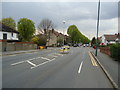
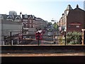
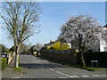
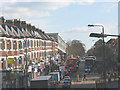
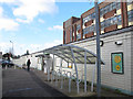
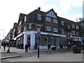
85 photos from this area
Area Information
Key information about the SM6 0SB including its size, population, and administrative classification.
- Area Type
- Postcode
- Area Size
- 1.6 hectares
- Population
- 1761
- Population Density
- 2950 people/km²
House Prices in SM6 0SB
36
Properties
£506,343
Average Sold Price
£125,000
Lowest Price
£900,000
Highest Price
Showing 36 properties
| Address | Type | Beds | Baths | Last Sale Price | Last Sale Date | |
|---|---|---|---|---|---|---|
| 2 Park Hill Road, Wallington, SM6 0SB | Semi-detached | 6 | 2 | £880,000 | Mar 2025 | |
| 10 Park Hill Road, Wallington, SM6 0SB | Detached | 1 | 1 | £350,000 | Dec 2022 | |
| 16 Park Hill Road, Wallington, SM6 0SB | Semi-detached | 5 | 1 | £747,000 | Nov 2019 | |
| 6 Park Hill Road, Wallington, SM6 0SB | Semi-detached | 1 | 1 | £712,500 | May 2019 | |
| Rosedale, 18 Park Hill Road, Wallington, SM6 0SB | Detached | 5 | 2 | £900,000 | Apr 2019 | |
| 54 Park Hill Road, Wallington, SM6 0SB | Semi-detached | 6 | 3 | £875,000 | Aug 2018 | |
| 32 Park Hill Road, Wallington, SM6 0SB | Semi-detached | 4 | - | £745,000 | Nov 2016 | |
| 40 Park Hill Road, Wallington, SM6 0SB | house | - | - | £495,000 | Oct 2012 | |
| 4 Park Hill Road, Wallington, SM6 0SB | Semi-detached | 6 | 2 | £510,000 | Aug 2012 | |
| 44 Park Hill Road, Wallington, SM6 0SB | house | - | - | £540,000 | Jan 2011 |
Page 1 of 4
Energy Efficiency in SM6 0SB
Amenities
Schools
| Rank | School | Type | Entry gender | Ages |
|---|
Explore more schools in this area
Go to Schools tabDemographics
Household Size
Family (3-5 people)
most common
Accommodation Type
Houses
most common
Tenure
92
majority
Ethnic Group
White
most common
Religion
N/A
most common
Household Composition
N/A
most common
Age
47
median
Adults (30-64 years)
most common
Household Deprivation
N/A
with no deprivation
NS-SEC
48
in Lower managerial occupations
Explore more demographic insights in this area
Go to Demographics tabPlanning
Planning Constraints
- Flood RiskPremium
- Ramsar Wetland SitesPremium
- Area of Outstanding Natural BeautyPremium
- Protected Nature ReservePremium
- Protected WoodlandPremium