Area Overview for SM5 4PY
Photos of SM5 4PY
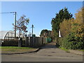
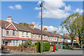
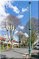
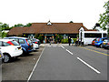
49 photos from this area
Area Information
Key information about the SM5 4PY including its size, population, and administrative classification.
- Area Type
- Postcode
- Area Size
- 1.6 hectares
- Population
- 1967
- Population Density
- 429 people/km²
House Prices in SM5 4PY
36
Properties
£487,295
Average Sold Price
£235,000
Lowest Price
£830,000
Highest Price
Showing 36 properties
| Address | Type | Beds | Baths | Last Sale Price | Last Sale Date | |
|---|---|---|---|---|---|---|
| 12 Burns Close, Carshalton, SM5 4PY | Semi-detached | 3 | 2 | £520,000 | Mar 2025 | |
| 16 Burns Close, Carshalton, SM5 4PY | house | - | - | £530,000 | Feb 2022 | |
| 9 Burns Close, Carshalton, SM5 4PY | Semi-detached | 4 | 3 | £625,000 | Dec 2021 | |
| 31 Burns Close, Carshalton, SM5 4PY | house | - | - | £830,000 | Sep 2021 | |
| 11 Burns Close, Carshalton, SM5 4PY | house | - | - | £610,000 | Jul 2021 | |
| 23 Burns Close, Carshalton, SM5 4PY | Detached | 5 | 3 | £775,000 | Aug 2020 | |
| 34 Burns Close, Carshalton, SM5 4PY | Detached | 4 | 2 | £737,000 | Jul 2020 | |
| 24 Burns Close, Carshalton, SM5 4PY | Detached | 4 | 2 | £750,000 | Jun 2019 | |
| 19 Burns Close, Carshalton, SM5 4PY | Semi-detached | 3 | 3 | £587,500 | Oct 2018 | |
| 13 Burns Close, Carshalton, SM5 4PY | Semi-detached | 3 | 2 | £490,000 | Oct 2018 |
Page 1 of 4
Energy Efficiency in SM5 4PY
Amenities
Schools
| Rank | School | Type | Entry gender | Ages |
|---|
Explore more schools in this area
Go to Schools tabDemographics
Household Size
Family (3-5 people)
most common
Accommodation Type
Houses
most common
Tenure
85
majority
Ethnic Group
White
most common
Religion
N/A
most common
Household Composition
N/A
most common
Age
47
median
Adults (30-64 years)
most common
Household Deprivation
N/A
with no deprivation
NS-SEC
46
in Lower managerial occupations
Explore more demographic insights in this area
Go to Demographics tabPlanning
Planning Constraints
- Flood RiskPremium
- Ramsar Wetland SitesPremium
- Area of Outstanding Natural BeautyPremium
- Protected Nature ReservePremium
- Protected WoodlandPremium