Area Overview for SM5 4JF
Photos of SM5 4JF
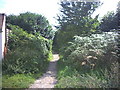
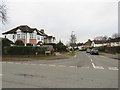
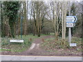
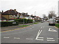
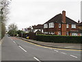
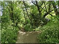
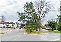
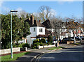
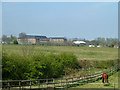
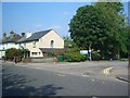
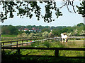
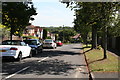
36 photos from this area
Area Information
Key information about the SM5 4JF including its size, population, and administrative classification.
- Area Type
- Postcode
- Area Size
- 1.5 hectares
- Population
- 1282
- Population Density
- 3427 people/km²
House Prices in SM5 4JF
22
Properties
£483,531
Average Sold Price
£114,000
Lowest Price
£875,000
Highest Price
Showing 22 properties
| Address | Type | Beds | Baths | Last Sale Price | Last Sale Date | |
|---|---|---|---|---|---|---|
| 2 Sunnymede Avenue, Carshalton, SM5 4JF | Semi-detached | 5 | 2 | £720,000 | Mar 2025 | |
| 40 Sunnymede Avenue, Carshalton, SM5 4JF | Semi-detached | 3 | 1 | £755,000 | Apr 2023 | |
| 42 Sunnymede Avenue, Carshalton, SM5 4JF | Retail | 5 | 3 | £875,000 | May 2022 | |
| 6 Sunnymede Avenue, Carshalton, SM5 4JF | house | - | - | £780,000 | Mar 2021 | |
| 14 Sunnymede Avenue, Carshalton, SM5 4JF | Semi-detached | 5 | 1 | £670,000 | Nov 2015 | |
| 16 Sunnymede Avenue, Carshalton, SM5 4JF | Semi-detached | 5 | 2 | £468,000 | Nov 2013 | |
| 24 Sunnymede Avenue, Carshalton, SM5 4JF | Semi-detached | 3 | - | £410,000 | Aug 2012 | |
| 26 Sunnymede Avenue, Carshalton, SM5 4JF | house | 3 | - | £422,500 | Mar 2012 | |
| 8 Sunnymede Avenue, Carshalton, SM5 4JF | house | 5 | - | £495,000 | Jul 2011 | |
| 30 Sunnymede Avenue, Carshalton, SM5 4JF | house | 3 | - | £380,000 | Jul 2010 |
Page 1 of 3
Energy Efficiency in SM5 4JF
Amenities
Schools
| Rank | School | Type | Entry gender | Ages |
|---|
Explore more schools in this area
Go to Schools tabDemographics
Household Size
Family (3-5 people)
most common
Accommodation Type
Houses
most common
Tenure
96
majority
Ethnic Group
White
most common
Religion
N/A
most common
Household Composition
N/A
most common
Age
47
median
Adults (30-64 years)
most common
Household Deprivation
N/A
with no deprivation
NS-SEC
51
in Lower managerial occupations
Explore more demographic insights in this area
Go to Demographics tabPlanning
Planning Constraints
- Flood RiskPremium
- Ramsar Wetland SitesPremium
- Area of Outstanding Natural BeautyPremium
- Protected Nature ReservePremium
- Protected WoodlandPremium