Area Overview for SM5 2NL
Photos of SM5 2NL
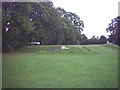
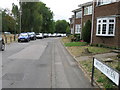
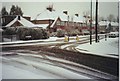
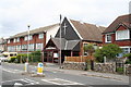

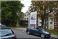
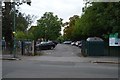
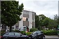
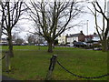
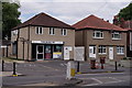
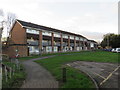
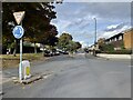
61 photos from this area
Area Information
Key information about the SM5 2NL including its size, population, and administrative classification.
- Area Type
- Postcode
- Area Size
- 6969 m²
- Population
- 1443
- Population Density
- 6143 people/km²
House Prices in SM5 2NL
51
Properties
£195,932
Average Sold Price
£39,950
Lowest Price
£360,000
Highest Price
Showing 51 properties
| Address | Type | Beds | Baths | Last Sale Price | Last Sale Date | |
|---|---|---|---|---|---|---|
| 22 Devana End, Carshalton, SM5 2NL | Flat | 3 | 1 | £360,000 | Sep 2025 | |
| 36 Devana End, Carshalton, SM5 2NL | Flat | 1 | 1 | £253,000 | Sep 2025 | |
| 7 Devana End, Carshalton, SM5 2NL | Flat | - | - | £209,000 | Jun 2025 | |
| 5 Devana End, Carshalton, SM5 2NL | Flat | 1 | 1 | £221,000 | Feb 2025 | |
| 40 Devana End, Carshalton, SM5 2NL | Flat | 2 | 1 | £290,000 | Feb 2025 | |
| 39 Devana End, Carshalton, SM5 2NL | Flat | - | - | £263,000 | Feb 2025 | |
| 49 Devana End, Carshalton, SM5 2NL | Flat | - | - | £294,000 | May 2024 | |
| 20 Devana End, Carshalton, SM5 2NL | Flat | - | - | £271,000 | Jan 2023 | |
| 32 Devana End, Carshalton, SM5 2NL | Flat | 2 | 1 | £300,000 | Oct 2022 | |
| 1 Devana End, Carshalton, SM5 2NL | Flat | 3 | 1 | £253,000 | Sep 2022 |
Page 1 of 6
Energy Efficiency in SM5 2NL
Amenities
Schools
| Rank | School | Type | Entry gender | Ages |
|---|
Explore more schools in this area
Go to Schools tabDemographics
Household Size
Family (3-5 people)
most common
Accommodation Type
Houses
most common
Tenure
78
majority
Ethnic Group
White
most common
Religion
N/A
most common
Household Composition
N/A
most common
Age
47
median
Adults (30-64 years)
most common
Household Deprivation
N/A
with no deprivation
NS-SEC
41
in Lower managerial occupations
Explore more demographic insights in this area
Go to Demographics tabPlanning
Planning Constraints
- Flood RiskPremium
- Ramsar Wetland SitesPremium
- Area of Outstanding Natural BeautyPremium
- Protected Nature ReservePremium
- Protected WoodlandPremium