Area Overview for SM5 1NB
Photos of SM5 1NB
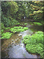
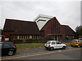
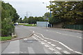
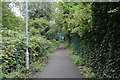


52 photos from this area
Area Information
Key information about the SM5 1NB including its size, population, and administrative classification.
- Area Type
- Postcode
- Area Size
- 7972 m²
- Population
- 1705
- Population Density
- 6173 people/km²
House Prices in SM5 1NB
40
Properties
£246,925
Average Sold Price
£85,000
Lowest Price
£450,000
Highest Price
Showing 40 properties
| Address | Type | Beds | Baths | Last Sale Price | Last Sale Date | |
|---|---|---|---|---|---|---|
| 39 Shrewsbury Road, Carshalton, SM5 1NB | Terraced | 3 | 1 | £450,000 | Jun 2025 | |
| 13 Shrewsbury Road, Carshalton, SM5 1NB | house | 2 | 1 | £411,000 | Feb 2022 | |
| 19 Shrewsbury Road, Carshalton, SM5 1NB | Terraced | 2 | 1 | £418,000 | Sep 2021 | |
| 65 Shrewsbury Road, Carshalton, SM5 1NB | house | - | - | £345,000 | Mar 2021 | |
| 35 Shrewsbury Road, Carshalton, SM5 1NB | house | - | - | £312,500 | Feb 2021 | |
| 23 Shrewsbury Road, Carshalton, SM5 1NB | Terraced | 4 | 1 | £353,000 | Jun 2018 | |
| 15 Shrewsbury Road, Carshalton, SM5 1NB | Terraced | 3 | 1 | £335,000 | Jul 2016 | |
| 27 Shrewsbury Road, Carshalton, SM5 1NB | Terraced | 3 | 1 | £248,000 | Jul 2013 | |
| 41 Shrewsbury Road, Carshalton, SM5 1NB | Terraced | 2 | 1 | £231,500 | May 2013 | |
| 63 Shrewsbury Road, Carshalton, SM5 1NB | house | 2 | - | £199,000 | Apr 2012 |
Page 1 of 4
Energy Efficiency in SM5 1NB
Amenities
Schools
| Rank | School | Type | Entry gender | Ages |
|---|
Explore more schools in this area
Go to Schools tabDemographics
Household Size
Family (3-5 people)
most common
Accommodation Type
Houses
most common
Tenure
50
majority
Ethnic Group
White
most common
Religion
N/A
most common
Household Composition
N/A
most common
Age
47
median
Adults (30-64 years)
most common
Household Deprivation
N/A
with no deprivation
NS-SEC
23
in Lower managerial occupations
Explore more demographic insights in this area
Go to Demographics tabPlanning
Planning Constraints
- Flood RiskPremium
- Ramsar Wetland SitesPremium
- Area of Outstanding Natural BeautyPremium
- Protected Nature ReservePremium
- Protected WoodlandPremium