Area Overview for SM5 1JG
Photos of SM5 1JG
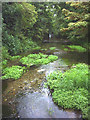
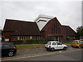
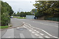
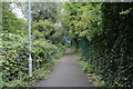


52 photos from this area
Area Information
Key information about the SM5 1JG including its size, population, and administrative classification.
- Area Type
- Postcode
- Area Size
- 1863 m²
- Population
- 1775
- Population Density
- 8326 people/km²
House Prices in SM5 1JG
23
Properties
£151,640
Average Sold Price
£44,950
Lowest Price
£350,000
Highest Price
Showing 23 properties
| Address | Type | Beds | Baths | Last Sale Price | Last Sale Date | |
|---|---|---|---|---|---|---|
| 9A Neville Walk, Carshalton, SM5 1JG | Flat | 1 | 1 | £170,000 | Mar 2023 | |
| 11 Neville Walk, Carshalton, SM5 1JG | Flat | 2 | 1 | £217,500 | Jul 2022 | |
| 8A Neville Walk, Carshalton, SM5 1JG | Flat | - | - | £125,000 | Sep 2021 | |
| 1 Neville Walk, Carshalton, SM5 1JG | Maisonette | 1 | 1 | £153,000 | Jan 2018 | |
| 3 Neville Walk, Carshalton, SM5 1JG | Maisonette | - | - | £350,000 | Mar 2017 | |
| 2A Neville Walk, Carshalton, SM5 1JG | Maisonette | 1 | 1 | £125,000 | Jan 2015 | |
| 9B Neville Walk, Carshalton, SM5 1JG | Flat | 1 | 1 | £86,000 | Jul 2011 | |
| 8B Neville Walk, Carshalton, SM5 1JG | Flat | - | 1 | £125,000 | Mar 2008 | |
| 1A Neville Walk, Carshalton, SM5 1JG | Maisonette | 1 | 1 | £119,950 | Aug 2005 | |
| 12 Neville Walk, Carshalton, SM5 1JG | Flat | - | - | £44,950 | Nov 1998 |
Page 1 of 3
Energy Efficiency in SM5 1JG
Amenities
Schools
| Rank | School | Type | Entry gender | Ages |
|---|
Explore more schools in this area
Go to Schools tabDemographics
Household Size
Family (3-5 people)
most common
Accommodation Type
Houses
most common
Tenure
44
majority
Ethnic Group
White
most common
Religion
N/A
most common
Household Composition
N/A
most common
Age
47
median
Adults (30-64 years)
most common
Household Deprivation
N/A
with no deprivation
NS-SEC
24
in Lower managerial occupations
Explore more demographic insights in this area
Go to Demographics tabPlanning
Planning Constraints
- Flood RiskPremium
- Ramsar Wetland SitesPremium
- Area of Outstanding Natural BeautyPremium
- Protected Nature ReservePremium
- Protected WoodlandPremium