Area Overview for SM5 1HU
Photos of SM5 1HU
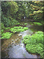
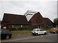
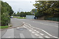
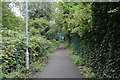


52 photos from this area
Area Information
Key information about the SM5 1HU including its size, population, and administrative classification.
- Area Type
- Postcode
- Area Size
- 2.9 hectares
- Population
- 1705
- Population Density
- 6173 people/km²
House Prices in SM5 1HU
49
Properties
£288,239
Average Sold Price
£69,000
Lowest Price
£476,100
Highest Price
Showing 49 properties
| Address | Type | Beds | Baths | Last Sale Price | Last Sale Date | |
|---|---|---|---|---|---|---|
| 469 Middleton Road, Carshalton, SM5 1HU | Terraced | 1 | 1 | £290,000 | Mar 2023 | |
| 415 Middleton Road, Carshalton, SM5 1HU | Terraced | 3 | 1 | £470,000 | Jan 2023 | |
| 401 Middleton Road, Carshalton, SM5 1HU | house | - | - | £476,100 | Aug 2022 | |
| 457 Middleton Road, Carshalton, SM5 1HU | Terraced | 3 | 1 | £371,000 | Nov 2019 | |
| 393 Middleton Road, Carshalton, SM5 1HU | house | - | - | £375,000 | Jul 2019 | |
| 399 Middleton Road, Carshalton, SM5 1HU | Terraced | 3 | 1 | £375,000 | Jan 2019 | |
| 453 Middleton Road, Carshalton, SM5 1HU | house | - | - | £346,000 | Sep 2018 | |
| 445 Middleton Road, Carshalton, SM5 1HU | Terraced | 2 | 1 | £340,000 | Aug 2017 | |
| 417 Middleton Road, Carshalton, SM5 1HU | Terraced | 3 | 1 | £355,000 | Nov 2016 | |
| 421 Middleton Road, Carshalton, SM5 1HU | Terraced | 4 | 2 | £340,000 | Feb 2016 |
Page 1 of 5
Energy Efficiency in SM5 1HU
Amenities
Schools
| Rank | School | Type | Entry gender | Ages |
|---|
Explore more schools in this area
Go to Schools tabDemographics
Household Size
Family (3-5 people)
most common
Accommodation Type
Houses
most common
Tenure
50
majority
Ethnic Group
White
most common
Religion
N/A
most common
Household Composition
N/A
most common
Age
47
median
Adults (30-64 years)
most common
Household Deprivation
N/A
with no deprivation
NS-SEC
23
in Lower managerial occupations
Explore more demographic insights in this area
Go to Demographics tabPlanning
Planning Constraints
- Flood RiskPremium
- Ramsar Wetland SitesPremium
- Area of Outstanding Natural BeautyPremium
- Protected Nature ReservePremium
- Protected WoodlandPremium