Area Overview for SM4 6RE
Photos of SM4 6RE


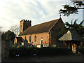
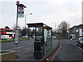
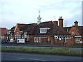


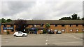
73 photos from this area
Area Information
Key information about the SM4 6RE including its size, population, and administrative classification.
- Area Type
- Postcode
- Area Size
- 4.1 hectares
- Population
- 1798
- Population Density
- 7966 people/km²
House Prices in SM4 6RE
62
Properties
£299,690
Average Sold Price
£106,950
Lowest Price
£505,000
Highest Price
Showing 62 properties
| Address | Type | Beds | Baths | Last Sale Price | Last Sale Date | |
|---|---|---|---|---|---|---|
| 5 Faversham Road, Morden, SM4 6RE | Terraced | 2 | 1 | £460,000 | Dec 2024 | |
| 24 Faversham Road, Morden, SM4 6RE | Terraced | 2 | 1 | £499,000 | May 2024 | |
| 47 Faversham Road, Morden, SM4 6RE | Terraced | 3 | 1 | £427,000 | Oct 2023 | |
| 53 Faversham Road, Morden, SM4 6RE | Terraced | 2 | 1 | £448,000 | Jul 2023 | |
| 41 Faversham Road, Morden, SM4 6RE | Terraced | 3 | 1 | £467,500 | Mar 2023 | |
| 30 Faversham Road, Morden, SM4 6RE | house | - | - | £390,000 | Dec 2021 | |
| 20 Faversham Road, Morden, SM4 6RE | house | - | - | £495,000 | Mar 2021 | |
| 28 Faversham Road, Morden, SM4 6RE | Terraced | 2 | 1 | £460,274 | Sep 2020 | |
| 27 Faversham Road, Morden, SM4 6RE | Terraced | 4 | 2 | £505,000 | May 2020 | |
| 50 Faversham Road, Morden, SM4 6RE | Flat | 1 | 1 | £450,000 | Oct 2019 |
Page 1 of 7
Energy Efficiency in SM4 6RE
Amenities
Schools
| Rank | School | Type | Entry gender | Ages |
|---|
Explore more schools in this area
Go to Schools tabDemographics
Household Size
Family (3-5 people)
most common
Accommodation Type
Houses
most common
Tenure
50
majority
Ethnic Group
White
most common
Religion
N/A
most common
Household Composition
N/A
most common
Age
47
median
Adults (30-64 years)
most common
Household Deprivation
N/A
with no deprivation
NS-SEC
25
in Lower managerial occupations
Explore more demographic insights in this area
Go to Demographics tabPlanning
Planning Constraints
- Flood RiskPremium
- Ramsar Wetland SitesPremium
- Area of Outstanding Natural BeautyPremium
- Protected Nature ReservePremium
- Protected WoodlandPremium