Area Overview for SM4 4QG
Photos of SM4 4QG


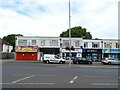
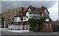
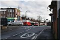
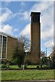
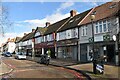
62 photos from this area
Area Information
Key information about the SM4 4QG including its size, population, and administrative classification.
- Area Type
- Postcode
- Area Size
- 2.1 hectares
- Population
- 1591
- Population Density
- 5300 people/km²
House Prices in SM4 4QG
68
Properties
£347,866
Average Sold Price
£86,500
Lowest Price
£630,000
Highest Price
Showing 68 properties
| Address | Type | Beds | Baths | Last Sale Price | Last Sale Date | |
|---|---|---|---|---|---|---|
| 93 Aragon Road, Morden, SM4 4QG | Terraced | 3 | 1 | £580,000 | Oct 2025 | |
| 101 Aragon Road, Morden, SM4 4QG | Terraced | 6 | 3 | £630,000 | Jul 2024 | |
| 137 Aragon Road, Morden, SM4 4QG | Terraced | 3 | 1 | £430,000 | Jun 2024 | |
| 55 Aragon Road, Morden, SM4 4QG | Terraced | 3 | 1 | £450,000 | Jun 2024 | |
| 121 Aragon Road, Morden, SM4 4QG | Terraced | 3 | 2 | £545,000 | Dec 2022 | |
| 83 Aragon Road, Morden, SM4 4QG | Terraced | 3 | 1 | £600,850 | Aug 2022 | |
| 43 Aragon Road, Morden, SM4 4QG | Terraced | 3 | 1 | £550,000 | Jul 2022 | |
| 51 Aragon Road, Morden, SM4 4QG | house | - | - | £550,000 | Sep 2021 | |
| 133 Aragon Road, Morden, SM4 4QG | house | 3 | 1 | £475,000 | Jun 2021 | |
| 113 Aragon Road, Morden, SM4 4QG | Terraced | 3 | 1 | £442,000 | Jun 2021 |
Page 1 of 7
Energy Efficiency in SM4 4QG
Amenities
Schools
| Rank | School | Type | Entry gender | Ages |
|---|
Explore more schools in this area
Go to Schools tabDemographics
Household Size
Family (3-5 people)
most common
Accommodation Type
Houses
most common
Tenure
83
majority
Ethnic Group
White
most common
Religion
N/A
most common
Household Composition
N/A
most common
Age
47
median
Adults (30-64 years)
most common
Household Deprivation
N/A
with no deprivation
NS-SEC
37
in Lower managerial occupations
Explore more demographic insights in this area
Go to Demographics tabPlanning
Planning Constraints
- Flood RiskPremium
- Ramsar Wetland SitesPremium
- Area of Outstanding Natural BeautyPremium
- Protected Nature ReservePremium
- Protected WoodlandPremium