Area Overview for SM3 9UU
Photos of SM3 9UU
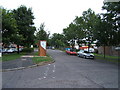
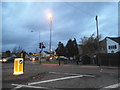
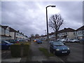
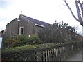
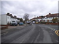
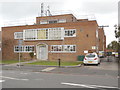
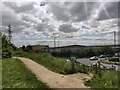
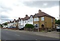
38 photos from this area
Area Information
Key information about the SM3 9UU including its size, population, and administrative classification.
- Area Type
- Postcode
- Area Size
- 1.2 hectares
- Population
- 1564
- Population Density
- 8167 people/km²
House Prices in SM3 9UU
30
Properties
£306,075
Average Sold Price
£97,798
Lowest Price
£678,000
Highest Price
Showing 30 properties
| Address | Type | Beds | Baths | Last Sale Price | Last Sale Date | |
|---|---|---|---|---|---|---|
| 13 Molesey Drive, North Cheam, SM3 9UU | Semi-detached | 4 | 2 | £678,000 | Apr 2023 | |
| 11 Molesey Drive, North Cheam, SM3 9UU | Terraced | 4 | 1 | £432,000 | Aug 2019 | |
| 23 Molesey Drive, North Cheam, SM3 9UU | Detached | 3 | 1 | £475,000 | May 2017 | |
| 25 Molesey Drive, North Cheam, SM3 9UU | house | - | - | £560,000 | Mar 2016 | |
| 3 Molesey Drive, North Cheam, SM3 9UU | Terraced | 3 | - | £352,000 | Dec 2014 | |
| 21 Molesey Drive, North Cheam, SM3 9UU | Terraced | - | - | £310,000 | May 2008 | |
| 17 Molesey Drive, North Cheam, SM3 9UU | Terraced | - | - | £285,000 | Oct 2007 | |
| 36 Molesey Drive, North Cheam, SM3 9UU | Terraced | - | - | £370,000 | Sep 2007 | |
| 34 Molesey Drive, North Cheam, SM3 9UU | Terraced | - | - | £259,950 | Aug 2006 | |
| 28 Molesey Drive, North Cheam, SM3 9UU | Terraced | - | - | £250,000 | Jan 2006 |
Page 1 of 3
Energy Efficiency in SM3 9UU
Amenities
Schools
| Rank | School | Type | Entry gender | Ages |
|---|
Explore more schools in this area
Go to Schools tabDemographics
Household Size
Family (3-5 people)
most common
Accommodation Type
Houses
most common
Tenure
92
majority
Ethnic Group
White
most common
Religion
N/A
most common
Household Composition
N/A
most common
Age
47
median
Adults (30-64 years)
most common
Household Deprivation
N/A
with no deprivation
NS-SEC
36
in Lower managerial occupations
Explore more demographic insights in this area
Go to Demographics tabPlanning
Planning Constraints
- Flood RiskPremium
- Ramsar Wetland SitesPremium
- Area of Outstanding Natural BeautyPremium
- Protected Nature ReservePremium
- Protected WoodlandPremium