Area Overview for SM3 9LB
Photos of SM3 9LB
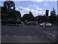
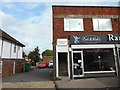
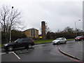
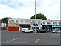
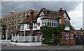
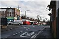
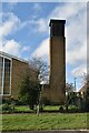
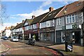
62 photos from this area
Area Information
Key information about the SM3 9LB including its size, population, and administrative classification.
- Area Type
- Postcode
- Area Size
- 1.2 hectares
- Population
- 1564
- Population Density
- 6476 people/km²
House Prices in SM3 9LB
34
Properties
£355,059
Average Sold Price
£88,000
Lowest Price
£675,000
Highest Price
Showing 34 properties
| Address | Type | Beds | Baths | Last Sale Price | Last Sale Date | |
|---|---|---|---|---|---|---|
| 102 Ash Road, Sutton, SM3 9LB | Semi-detached | 4 | 2 | £660,000 | Sep 2021 | |
| 48 Ash Road, Sutton, SM3 9LB | house | - | - | £521,000 | Sep 2019 | |
| 44 Ash Road, Sutton, SM3 9LB | house | - | - | £675,000 | Nov 2017 | |
| 94 Ash Road, Sutton, SM3 9LB | Semi-detached | 3 | 1 | £435,000 | Apr 2016 | |
| 64 Ash Road, Sutton, SM3 9LB | house | 4 | - | £470,000 | Mar 2016 | |
| 80 Ash Road, Sutton, SM3 9LB | Semi-detached | 3 | - | £440,000 | Sep 2015 | |
| 56 Ash Road, Sutton, SM3 9LB | house | - | - | £390,000 | Apr 2010 | |
| 96 Ash Road, Sutton, SM3 9LB | Semi-detached | 3 | 2 | £310,000 | Feb 2008 | |
| Flat 1, 104 Ash Road, Sutton, SM3 9LB | Detached | - | - | £200,000 | Jun 2006 | |
| 46 Ash Road, Sutton, SM3 9LB | Terraced | - | - | £330,000 | May 2006 |
Page 1 of 4
Energy Efficiency in SM3 9LB
Amenities
Schools
| Rank | School | Type | Entry gender | Ages |
|---|
Explore more schools in this area
Go to Schools tabDemographics
Household Size
Family (3-5 people)
most common
Accommodation Type
Houses
most common
Tenure
88
majority
Ethnic Group
White
most common
Religion
N/A
most common
Household Composition
N/A
most common
Age
47
median
Adults (30-64 years)
most common
Household Deprivation
N/A
with no deprivation
NS-SEC
32
in Lower managerial occupations
Explore more demographic insights in this area
Go to Demographics tabPlanning
Planning Constraints
- Flood RiskPremium
- Ramsar Wetland SitesPremium
- Area of Outstanding Natural BeautyPremium
- Protected Nature ReservePremium
- Protected WoodlandPremium