Area Overview for SM2 6AY
Photos of SM2 6AY
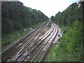
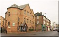


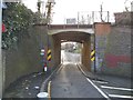
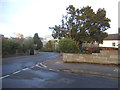


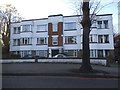

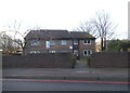
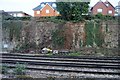
36 photos from this area
Area Information
Key information about the SM2 6AY including its size, population, and administrative classification.
- Area Type
- Postcode
- Area Size
- 2955 m²
- Population
- 1928
- Population Density
- 11157 people/km²
House Prices in SM2 6AY
44
Properties
£242,935
Average Sold Price
£78,000
Lowest Price
£340,000
Highest Price
Showing 44 properties
| Address | Type | Beds | Baths | Last Sale Price | Last Sale Date | |
|---|---|---|---|---|---|---|
| 36, Alford Court, Bonchurch Close, Sutton, SM2 6AY | Flat | 2 | 1 | £335,000 | May 2025 | |
| 19, Alford Court, Bonchurch Close, Sutton, SM2 6AY | Flat | - | - | £323,000 | Jan 2025 | |
| 26, Alford Court, Bonchurch Close, Sutton, SM2 6AY | Flat | - | - | £295,000 | Oct 2024 | |
| 29, Alford Court, Bonchurch Close, Sutton, SM2 6AY | Flat | - | - | £290,000 | Jul 2024 | |
| 31, Alford Court, Bonchurch Close, Sutton, SM2 6AY | Flat | 2 | - | £340,000 | Nov 2023 | |
| 5, Alford Court, Bonchurch Close, Sutton, SM2 6AY | Flat | 2 | 1 | £332,000 | Aug 2023 | |
| 16, Alford Court, Bonchurch Close, Sutton, SM2 6AY | Flat | - | - | £318,000 | Jun 2022 | |
| 8, Alford Court, Bonchurch Close, Sutton, SM2 6AY | Flat | 2 | 1 | £305,000 | Feb 2022 | |
| 43, Alford Court, Bonchurch Close, Sutton, SM2 6AY | Flat | - | - | £300,000 | May 2021 | |
| 14, Alford Court, Bonchurch Close, Sutton, SM2 6AY | Flat | - | - | £255,000 | Mar 2020 |
Page 1 of 5
Energy Efficiency in SM2 6AY
Amenities
Schools
| Rank | School | Type | Entry gender | Ages |
|---|
Explore more schools in this area
Go to Schools tabDemographics
Household Size
One person
most common
Accommodation Type
Flats
most common
Tenure
46
majority
Ethnic Group
White
most common
Religion
N/A
most common
Household Composition
N/A
most common
Age
47
median
Adults (30-64 years)
most common
Household Deprivation
N/A
with no deprivation
NS-SEC
42
in Lower managerial occupations
Explore more demographic insights in this area
Go to Demographics tabPlanning
Planning Constraints
- Flood RiskPremium
- Ramsar Wetland SitesPremium
- Area of Outstanding Natural BeautyPremium
- Protected Nature ReservePremium
- Protected WoodlandPremium