Area Overview for SM2 5NG
Photos of SM2 5NG
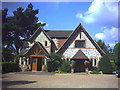
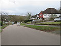
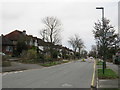
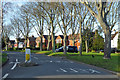
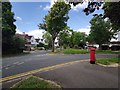
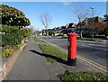
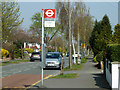

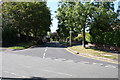
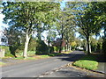
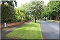
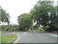
19 photos from this area
Area Information
Key information about the SM2 5NG including its size, population, and administrative classification.
- Area Type
- Postcode
- Area Size
- 4.8 hectares
- Population
- 1507
- Population Density
- 2323 people/km²
House Prices in SM2 5NG
18
Properties
£236,350
Average Sold Price
£128,000
Lowest Price
£471,500
Highest Price
Showing 18 properties
| Address | Type | Beds | Baths | Last Sale Price | Last Sale Date | |
|---|---|---|---|---|---|---|
| 7B Cotswold Road, Sutton, SM2 5NG | Maisonette | 1 | 1 | £215,000 | Oct 2020 | |
| 9 Cotswold Road, Sutton, SM2 5NG | Semi-detached | 2 | 2 | £471,500 | Jun 2019 | |
| 7A Cotswold Road, Sutton, SM2 5NG | Maisonette | 1 | 1 | £235,000 | Oct 2016 | |
| 5B Cotswold Road, Sutton, SM2 5NG | Maisonette | 1 | - | £200,000 | Aug 2015 | |
| 11 Cotswold Road, Sutton, SM2 5NG | house | - | - | £265,000 | May 2007 | |
| 5A Cotswold Road, Sutton, SM2 5NG | Semi-detached | - | - | £139,950 | Nov 2003 | |
| 3A Cotswold Road, Sutton, SM2 5NG | Flat | - | - | £128,000 | Aug 2001 | |
| Barista & Baker Café, Cafe Oak Cancer Centre, The Royal Marsden Hospital, Downs Road, Sutton, SM2 5NG | Restaurant | - | - | - | - | |
| Rm Medicines, Pharmacy Oak Cancer Centre, The Royal Marsden Hospital, Downs Road, Sutton, SM2 5NG | shop | - | - | - | - | |
| Maggie's Centre, 2 Oakleaf Avenue, Sutton, SM2 5NG | commercial | - | - | - | - |
Page 1 of 2
Energy Efficiency in SM2 5NG
Amenities
Schools
| Rank | School | Type | Entry gender | Ages |
|---|
Explore more schools in this area
Go to Schools tabDemographics
Household Size
Family (3-5 people)
most common
Accommodation Type
Houses
most common
Tenure
81
majority
Ethnic Group
White
most common
Religion
N/A
most common
Household Composition
N/A
most common
Age
47
median
Adults (30-64 years)
most common
Household Deprivation
N/A
with no deprivation
NS-SEC
49
in Lower managerial occupations
Explore more demographic insights in this area
Go to Demographics tabPlanning
Planning Constraints
- Flood RiskPremium
- Ramsar Wetland SitesPremium
- Area of Outstanding Natural BeautyPremium
- Protected Nature ReservePremium
- Protected WoodlandPremium