Area Overview for SM2 5ES
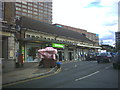
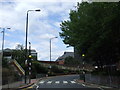
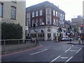
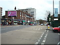
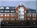
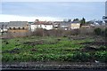
Photos of SM2 5ES


Area Information
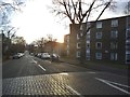
The SM2 5ES postcode covers a compact residential cluster in England, encompassing an area of 4,894 square metres. With a resident population of 1,986, this specific location offers a defined neighbourhood for those seeking a contained community within the Greater London context. Daily life here is shaped by the proximity to key transport hubs and retail outlets that serve the immediate surroundings. The area functions as a practical residential choice where residents benefit from established amenities within a very small geographic footprint. Living in SM2 5ES means accessing a self-contained environment where the population density reaches 405,770 people per square kilometre, creating an urban feel despite the limited physical space. Homes in this postcode are situated close to major thoroughfares, facilitating access to wider transport networks connecting residents to central London and beyond. The character of the area is defined by its high density and integration with the surrounding postal code sector, making it a straightforward option for buyers focused on connectivity and compact living arrangements.
- Area Type
- Postcode
- Area Size
- 4894 m²
- Population
- 1986
- Population Density
- 12305 people/km²
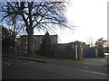
The housing landscape in SM2 5ES is characterised by a high concentration of flats, which constitutes the main accommodation type in this specific postcode. With only 29 per cent of the population owning their homes, the area presents a complex market heavily influenced by the private rental sector. Buyers looking for single-family detached or semi-detached homes in this exact postcode may find limited stock, as the physical size of the area is just 4,894 square metres, favouring multi-unit developments. However, the surrounding neighbourhoods within the SM2 sector often provide traditional house types such as semi-detached and terraced properties. For someone seeking a specific property style, you may need to look at adjacent postcodes in Sutton or neighboring districts. The prevalence of rental housing suggests an investment opportunity or a transient population, while the 29 per cent ownership rate indicates some stability within the lower density pockets of the wider SM2 region.
House Prices in SM2 5ES
Showing 64 properties
| Address | Type | Beds | Baths | Last Sale Price | Last Sale Date | |
|---|---|---|---|---|---|---|
| 28 Ambleside Gardens, Sutton, SM2 5ES | Flat | - | - | £295,000 | Mar 2023 | |
| 11 Ambleside Gardens, Sutton, SM2 5ES | Flat | - | - | £290,000 | Jun 2021 | |
| 61 Ambleside Gardens, Sutton, SM2 5ES | Flat | - | - | £257,000 | Jun 2021 | |
| 26 Ambleside Gardens, Sutton, SM2 5ES | Flat | - | - | £220,000 | Mar 2021 | |
| 42 Ambleside Gardens, Sutton, SM2 5ES | Flat | 2 | 1 | £280,000 | Dec 2017 | |
| 37 Ambleside Gardens, Sutton, SM2 5ES | Flat | - | - | £275,000 | Jul 2017 | |
| 31 Ambleside Gardens, Sutton, SM2 5ES | Flat | - | - | £280,000 | Jan 2017 | |
| 43 Ambleside Gardens, Sutton, SM2 5ES | Flat | - | - | £205,000 | Sep 2015 | |
| 18 Ambleside Gardens, Sutton, SM2 5ES | Flat | - | - | £127,000 | Feb 2013 | |
| 14 Ambleside Gardens, Sutton, SM2 5ES | Flat | - | - | £156,000 | Feb 2013 |
Energy Efficiency in SM2 5ES
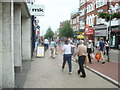
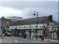
Residents of SM2 5ES enjoy access to a variety of retail and leisure facilities located within practical reach. Five major retail outlets are nearby, including Tesco Sutton, M&S Sutton Rail SF, and Morrisons Sutton, ensuring you can purchase groceries and household goods without traveling far. Transport enthusiasts will find five rail stations and five tram stops accessible, providing five different routes to explore the wider London network. The area near your home benefits from the presence of these large commercial providers, which often serve as social anchors in the local community. While the immediate 4,894 square metre cluster is compact, the wider neighbourhood offers sufficient commercial density to meet daily needs. You will find that lifestyle in this area is driven by convenience, with essential services and transport hubs clustered to simplify your routine. This accessibility means you do not need to venture far for errands, groceries, or transit to other parts of the borough.
Amenities
Schools
| Rank | School | Type | Entry gender | Ages |
|---|
Explore more schools in this area
Go to Schools tabDemographics
Community profiles in SM2 5ES reflect a mature demographic with a median age of 47 years. The most common age group comprises adults between 30 and 64 years, indicating a neighbourhood dominated by working-age families and established professionals. Home ownership stands at 29 per cent, suggesting that a significant portion of the owner-occupancy base resides here, though rental properties likely form a substantial part of the market. Flats represent the predominant type of accommodation, aligning with the area's high-density residential nature. The district remains largely homogenous, with White residents forming the predominant ethnic group. This age structure implies that you will find a community where many residents are well settled, though the median age suggests a lower proportion of school-aged children compared to other suburban areas. Understanding these demographics helps you assess whether the local vibe matches your expectations for neighbours and community interaction when considering homes in SM2 5ES.
Household Size
Accommodation Type
Tenure
Ethnic Group
Religion
Household Composition
Age
Household Deprivation
NS-SEC
Explore more demographic insights in this area
Go to Demographics tabPlanning
Planning Constraints
- Flood RiskPremium
- Ramsar Wetland SitesPremium
- Area of Outstanding Natural BeautyPremium
- Protected Nature ReservePremium
- Protected WoodlandPremium