Area Overview for SM2 5EJ
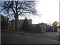
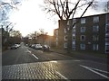
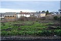
Photos of SM2 5EJ


Area Information
SM2 5EJ is a specific postcode covering a small residential cluster in England. You will find 1,928 people living across just 6,768 square metres. This compact footprint results in an extremely high population density of 284,870 people per square kilometre. Living in this area means navigating a tightly packed environment where neighbours are often close by. The character of the locality is defined by this concentration of homes within a restricted geographical boundary. Daily life involves making the most of immediate local resources while dealing with the implications of such high density. The area functions as a distinct cluster rather than a broad neighbourhood, offering a concentrated living experience. You should expect a community where space is at a premium. Understanding the sheer scale of the population relative to the land size is essential before considering a move here. The living environment is intense due to the sheer number of residents packed into this small footprint.
- Area Type
- Postcode
- Area Size
- 6768 m²
- Population
- 1928
- Population Density
- 11157 people/km²
The property market in SM2 5EJ is characterised by a significant split between ownership and rental tenancies. With home ownership at 46 per cent, the area is slightly more balanced than many purely commuter enclaves but still leans towards rented accommodation in some respects. The predominant accommodation type consists of flats. This suggests a housing stock designed for smaller households or individuals seeking low-maintenance living. You will find a high proportion of flats within the 6,768 square metres of the postcode. This mix appeals to professionals who value space efficiency and proximity to transport links. The market reflects the dense residential nature of the cluster. Buyers should expect a landscape defined by multi-unit buildings rather than detached houses. The 46 per cent ownership figure indicates a stable block of residents who have invested in the local estate. Flats remain the primary asset class here, driving the character of the property street.
House Prices in SM2 5EJ
Showing 68 properties
| Address | Type | Beds | Baths | Last Sale Price | Last Sale Date | |
|---|---|---|---|---|---|---|
| 18, Laurel Manor, 18 Devonshire Road, Sutton, SM2 5EJ | Flat | - | - | £260,050 | Feb 2016 | |
| 35, Laurel Manor, 18 Devonshire Road, Sutton, SM2 5EJ | Flat | 2 | 1 | - | - | |
| 61, Laurel Manor, 18 Devonshire Road, Sutton, SM2 5EJ | Flat | 1 | 1 | - | - | |
| 60, Laurel Manor, 18 Devonshire Road, Sutton, SM2 5EJ | Flat | 2 | 1 | - | - | |
| 9, Laurel Manor, 18 Devonshire Road, Sutton, SM2 5EJ | Flat | 1 | 1 | - | - | |
| 41, Laurel Manor, 18 Devonshire Road, Sutton, SM2 5EJ | Flat | 1 | 1 | - | - | |
| 34, Laurel Manor, 18 Devonshire Road, Sutton, SM2 5EJ | Flat | 1 | 1 | - | - | |
| 7, Laurel Manor, 18 Devonshire Road, Sutton, SM2 5EJ | Flat | 1 | 1 | - | - | |
| 37, Laurel Manor, 18 Devonshire Road, Sutton, SM2 5EJ | Flat | 3 | 1 | - | - | |
| 67, Laurel Manor, 18 Devonshire Road, Sutton, SM2 5EJ | Flat | 1 | 1 | - | - |
Energy Efficiency in SM2 5EJ
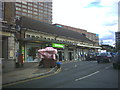
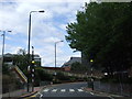
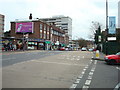
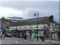
Your daily lifestyle in SM2 5EJ is heavily influenced by the range of shopping and transport amenities within easy reach. You have access to five retail outlets, with notable locations including Tesco Sutton, M&S Sutton Rail SF, and Morrisons Sutton. These supermarkets and department stores provide essential goods and general shopping needs without a long journey. For your commute, five rail stations serve the locality, while five metro tram stops offer lighter, rapid transit options. Specific tram stops include Mitcham Tram Stop, Beddington Lane Tram Stop, and Belgrave Walk Tram Stop. This concentration of five shops and ten public transport hubs ensures high convenience. You do not need to travel far to access daily necessities. The presence of Tesco and Morrisons anchors the local retail experience. Transport links allow you to leave the area quickly via bus, train, or tram. The proximity of these five key venues simplifies household logistics and errands.
Amenities
Schools
Education options for SM2 5EJ are straightforward due to the limited geographical size of the postcode. The nearest school is Devonshire Primary School, which operates as a primary institution. It holds a Good Ofsted rating, confirming its quality and effectiveness. As a primary school, it caters specifically to the early stages of compulsory education. You will not find secondary schools listed for this immediate cluster in the available data. This means families with older children may need to look further afield for secondary education options. The presence of a single Good-rated primary school highlights the immediate academic provision. Parents must plan carefully, as the local cluster relies on this specific facility for the youngest learners. There is no secondary or independent school data attached to this immediate area. The school provides a solid foundation for children living in the high-density flat blocks.
| Rank | School | Type | Entry gender | Ages |
|---|
Explore more schools in this area
Go to Schools tabDemographics
The community in SM2 5EJ has a distinctly mature demographic profile. The median age stands at 47 years, with adults aged 30 to 64 representing the most common age range. This data indicates a population dominated by established households rather than young families or retirees. Home ownership accounts for 46 per cent of residents, meaning nearly half of the housing stock is privately owned. The remaining homes are predominantly flats, suggesting a mix of leasehold and freehold properties. The predominant ethnic group is White, shaping the cultural makeup of the cluster. You are looking at an area where adults form the core of the community. The high population density combined with this age profile creates a specific social dynamic. Deborahs Primary School serves the local families, reflecting the presence of working-age adults. The housing stock supports a lifestyle typical of middle-aged earners or those with significant equity.
Household Size
Accommodation Type
Tenure
Ethnic Group
Religion
Household Composition
Age
Household Deprivation
NS-SEC
Explore more demographic insights in this area
Go to Demographics tabPlanning
Planning Constraints
- Flood RiskPremium
- Ramsar Wetland SitesPremium
- Area of Outstanding Natural BeautyPremium
- Protected Nature ReservePremium
- Protected WoodlandPremium