Area Overview for SM2 5DJ
Photos of SM2 5DJ


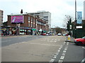

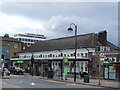

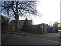
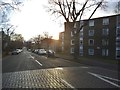
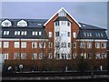
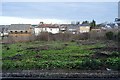

46 photos from this area
Area Information
Key information about the SM2 5DJ including its size, population, and administrative classification.
- Area Type
- Postcode
- Area Size
- 1.1 hectares
- Population
- 1966
- Population Density
- 9791 people/km²
House Prices in SM2 5DJ
81
Properties
£486,993
Average Sold Price
£149,950
Lowest Price
£910,000
Highest Price
Showing 81 properties
| Address | Type | Beds | Baths | Last Sale Price | Last Sale Date | |
|---|---|---|---|---|---|---|
| 63 Cedar Road, Sutton, SM2 5DJ | Semi-detached | 6 | 4 | £910,000 | Feb 2025 | |
| 39 Cedar Road, Sutton, SM2 5DJ | house | - | - | £820,000 | Apr 2023 | |
| 43 Cedar Road, Sutton, SM2 5DJ | Semi-detached | 5 | 2 | £910,000 | Aug 2022 | |
| 69 Cedar Road, Sutton, SM2 5DJ | Flat | - | - | £275,000 | Dec 2014 | |
| 51 Cedar Road, Sutton, SM2 5DJ | Semi-detached | 5 | 2 | £149,950 | Sep 2003 | |
| 53 Cedar Road, Sutton, SM2 5DJ | Semi-detached | 4 | 2 | £177,000 | Jan 1999 | |
| 41 Cedar Road, Sutton, SM2 5DJ | Maisonette | 2 | - | £167,000 | Mar 1997 | |
| Flat 4, 65 Cedar Road, Sutton, SM2 5DJ | Flat | 2 | 1 | - | - | |
| 65 Cedar Road, Sutton, SM2 5DJ | Semi-detached | 7 | 6 | - | - | |
| First Floor, 55 Cedar Road, Sutton, SM2 5DJ | undefined | - | - | - | - |
Page 1 of 9
Energy Efficiency in SM2 5DJ
Amenities
Schools
| Rank | School | Type | Entry gender | Ages |
|---|
Explore more schools in this area
Go to Schools tabDemographics
Household Size
One person
most common
Accommodation Type
Flats
most common
Tenure
44
majority
Ethnic Group
White
most common
Religion
N/A
most common
Household Composition
N/A
most common
Age
47
median
Adults (30-64 years)
most common
Household Deprivation
N/A
with no deprivation
NS-SEC
44
in Lower managerial occupations
Explore more demographic insights in this area
Go to Demographics tabPlanning
Planning Constraints
- Flood RiskPremium
- Ramsar Wetland SitesPremium
- Area of Outstanding Natural BeautyPremium
- Protected Nature ReservePremium
- Protected WoodlandPremium