Area Overview for SM2 5BW
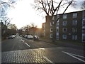
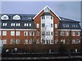
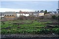
Photos of SM2 5BW

Area Information
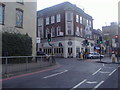
SM2 5BW is a compact residential cluster in south London covering just 2.3 hectares. Despite this small footprint, the area accommodates a population of 1,986 people, resulting in a high density of 87,992 residents per square kilometre. The environment represents a specific postcode area rather than a broad neighbourhood, featuring a tightly knit residential fabric where daily routines evolve close to home. Living in SM2 5BW means operating within an urban setting where space is at a premium. You can expect a community character driven by proximity to transport hubs and local shopping options. The area functions as a dense pocket of city life, distinct from larger suburban sprawl. Daily commuting and access to services happen immediately around your doorstep. This high density ensures that essential facilities are nearby, reducing travel friction for most residents. The location serves as a direct entry point into the wider Sutton and Carshalton landscape. Homebuyers looking for a micro-community within the broader London transport network will find this specific cluster distinct. It offers a focused living experience without the sprawl of wider districts.
- Area Type
- Postcode
- Area Size
- 2.3 hectares
- Population
- 1986
- Population Density
- 12305 people/km²
The housing landscape in SM2 5BW is defined by a high concentration of flats. Only 29% of residents own their homes, meaning the market is heavily weighted towards renting. This low ownership rate characterises the area as a significant rental hub within the SM2 postcode region. Prospective buyers should understand that this is primarily a market for leaseholders and tenants rather than freehold owners. The small area size of 2.3 hectares limits the variety of housing styles typically found in larger neighbourhoods. Consequently, you will likely encounter apartment blocks and shared ownership schemes rather than detached family homes. This structure appeals to individuals and couples who prioritise low maintenance living and convenient transport links over traditional house ownership. For those seeking to purchase, the market dynamics differ from suburban streets filled with detached properties. The prevalence of flats means that you are entering a building-related community where shared corridors and communal facilities play a larger role in daily life. Understanding this inventory mix is essential before viewing properties in this specific cluster. The data confirms that investment and rental yield might differ from standard owner-occupied properties found in less dense locations.
House Prices in SM2 5BW
Showing 82 properties
Energy Efficiency in SM2 5BW
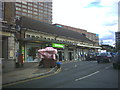
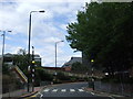
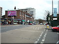
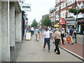
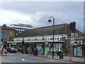
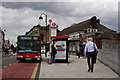
Daily life in SM2 5BW centres on a collection of major retailers and transport hubs located within practical reach. You can access five key retail destinations, including M&S Sutton Rail SF, Tesco Sutton, and Morrisons Sutton, ensuring groceries and daily essentials are easily obtainable. The area sits adjacent to significant transport corridors that double as community meeting points, with five rail stations and five tram stops nearby. Carshalton Station and Carshalton Beeches serve as primary interchange points for your commute or leisure travel. For those preferring light rail, the Mitcham Tram Stop, Beddington Lane Tram Stop, and Belgrave Walk Tram Stop are all within easy walking distance. A single ferry terminal at Kingston Town End Pier offers an alternative mode of transport for residents. This concentration of amenities means you do not need a car for basic shopping or socialising. The layout encourages walking to supermarkets and stations. Retail presence is strong with the inclusion of Morrisons and Tesco, which are vital for household management. This variety of transport modes and shopping options creates a self-contained lifestyle environment. You will find that the immediate surroundings support a full range of weekly requirements without requiring extensive travel.
Amenities
Schools
| Rank | School | Type | Entry gender | Ages |
|---|
Explore more schools in this area
Go to Schools tabDemographics
The community profile of SM2 5BW is dominated by adults aged between 30 and 64 years. The median age stands at 47, indicating that families with dependent children or established professionals form the core of the demographic. Only 29% of households own their homes, which places the area significantly below the national average for home ownership. This figure suggests that the local rental market is robust and active. The predominant accommodation type consists of flats, aligning with the high-density nature of the 2.3-hectare site. Regarding diversity, the predominant ethnic group in the area is White, mirroring many traditional south London postcodes. The age distribution and housing stock create a snapshot of a settled community rather than a transient student population. You will find a demographic that has lived in south London for a significant period. The concentration of older adults combined with professional singles and couples shapes social interactions and community engagement. This demographic balance supports steady demand for rental properties while maintaining a stable environment for long-term tenants and leaseholders across the cluster.
Household Size
Accommodation Type
Tenure
Ethnic Group
Religion
Household Composition
Age
Household Deprivation
NS-SEC
Explore more demographic insights in this area
Go to Demographics tabPlanning
Planning Constraints
- Flood RiskPremium
- Ramsar Wetland SitesPremium
- Area of Outstanding Natural BeautyPremium
- Protected Nature ReservePremium
- Protected WoodlandPremium