Area Overview for SM1 4RP
Photos of SM1 4RP
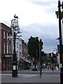
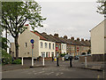
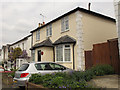

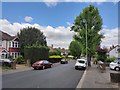

54 photos from this area
Area Information
Key information about the SM1 4RP including its size, population, and administrative classification.
- Area Type
- Postcode
- Area Size
- 1.1 hectares
- Population
- 2556
- Population Density
- 11032 people/km²
House Prices in SM1 4RP
57
Properties
£345,302
Average Sold Price
£56,500
Lowest Price
£600,000
Highest Price
Showing 57 properties
| Address | Type | Beds | Baths | Last Sale Price | Last Sale Date | |
|---|---|---|---|---|---|---|
| 24 Morland Road, Sutton, SM1 4RP | house | - | - | £482,000 | May 2025 | |
| 3 Morland Road, Sutton, SM1 4RP | Terraced | 2 | 1 | £447,000 | Mar 2025 | |
| 48 Morland Road, Sutton, SM1 4RP | Terraced | 2 | 1 | £420,000 | Nov 2024 | |
| 21 Morland Road, Sutton, SM1 4RP | Terraced | 3 | 2 | £600,000 | Dec 2023 | |
| 14 Morland Road, Sutton, SM1 4RP | Terraced | 2 | 1 | £460,000 | Jul 2023 | |
| 10 Morland Road, Sutton, SM1 4RP | Terraced | 2 | 2 | £425,000 | May 2023 | |
| 15 Morland Road, Sutton, SM1 4RP | Terraced | 2 | 2 | £433,000 | Mar 2023 | |
| 37 Morland Road, Sutton, SM1 4RP | Terraced | 2 | 1 | £450,000 | Mar 2023 | |
| 44 Morland Road, Sutton, SM1 4RP | Terraced | 3 | 2 | £570,000 | Nov 2022 | |
| 13 Morland Road, Sutton, SM1 4RP | house | - | - | £393,000 | Aug 2022 |
Page 1 of 6
Energy Efficiency in SM1 4RP
Amenities
Schools
| Rank | School | Type | Entry gender | Ages |
|---|
Explore more schools in this area
Go to Schools tabDemographics
Household Size
One person
most common
Accommodation Type
Flats
most common
Tenure
43
majority
Ethnic Group
White
most common
Religion
N/A
most common
Household Composition
N/A
most common
Age
47
median
Adults (30-64 years)
most common
Household Deprivation
N/A
with no deprivation
NS-SEC
50
in Lower managerial occupations
Explore more demographic insights in this area
Go to Demographics tabPlanning
Planning Constraints
- Flood RiskPremium
- Ramsar Wetland SitesPremium
- Area of Outstanding Natural BeautyPremium
- Protected Nature ReservePremium
- Protected WoodlandPremium