Area Overview for SM1 4JL
Photos of SM1 4JL
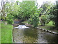
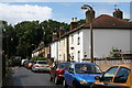

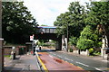
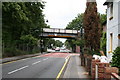
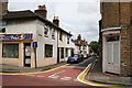
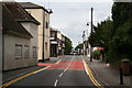
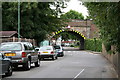
100 photos from this area
Area Information
Key information about the SM1 4JL including its size, population, and administrative classification.
- Area Type
- Postcode
- Area Size
- 5355 m²
- Population
- 1409
- Population Density
- 6290 people/km²
House Prices in SM1 4JL
17
Properties
£322,188
Average Sold Price
£85,000
Lowest Price
£765,000
Highest Price
Showing 17 properties
| Address | Type | Beds | Baths | Last Sale Price | Last Sale Date | |
|---|---|---|---|---|---|---|
| 134 Westmead Road, Sutton, SM1 4JL | house | - | - | £765,000 | Feb 2022 | |
| 135 Westmead Road, Sutton, SM1 4JL | house | - | - | £515,000 | Jun 2021 | |
| 125 Westmead Road, Sutton, SM1 4JL | Semi-detached | 3 | - | £307,500 | Oct 2013 | |
| 128 Westmead Road, Sutton, SM1 4JL | Semi-detached | - | - | £273,000 | Apr 2006 | |
| 126 Westmead Road, Sutton, SM1 4JL | house | - | - | £237,000 | Dec 2005 | |
| 131 Westmead Road, Sutton, SM1 4JL | Terraced | - | - | £210,000 | Sep 2002 | |
| 127 Westmead Road, Sutton, SM1 4JL | Detached | 3 | 1 | £185,000 | Feb 2002 | |
| 133 Westmead Road, Sutton, SM1 4JL | Terraced | - | - | £85,000 | Oct 1995 | |
| Flat 2, 129 Westmead Road, Sutton, SM1 4JL | Flat | 2 | 1 | - | - | |
| Flat 3, 130 Westmead Road, Sutton, SM1 4JL | Flat | - | - | - | - |
Page 1 of 2
Energy Efficiency in SM1 4JL
Amenities
Schools
| Rank | School | Type | Entry gender | Ages |
|---|
Explore more schools in this area
Go to Schools tabDemographics
Household Size
Family (3-5 people)
most common
Accommodation Type
Houses
most common
Tenure
87
majority
Ethnic Group
White
most common
Religion
N/A
most common
Household Composition
N/A
most common
Age
47
median
Adults (30-64 years)
most common
Household Deprivation
N/A
with no deprivation
NS-SEC
45
in Lower managerial occupations
Explore more demographic insights in this area
Go to Demographics tabPlanning
Planning Constraints
- Flood RiskPremium
- Ramsar Wetland SitesPremium
- Area of Outstanding Natural BeautyPremium
- Protected Nature ReservePremium
- Protected WoodlandPremium