Area Overview for SM1 4HW
Photos of SM1 4HW
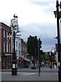
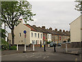
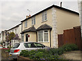

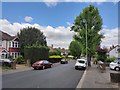

54 photos from this area
Area Information
Key information about the SM1 4HW including its size, population, and administrative classification.
- Area Type
- Postcode
- Area Size
- 4306 m²
- Population
- 1825
- Population Density
- 15145 people/km²
House Prices in SM1 4HW
24
Properties
£252,386
Average Sold Price
£164,000
Lowest Price
£357,000
Highest Price
Showing 24 properties
| Address | Type | Beds | Baths | Last Sale Price | Last Sale Date | |
|---|---|---|---|---|---|---|
| 9 Glena Mount, Sutton, SM1 4HW | Flat | 3 | 1 | £350,000 | Dec 2025 | |
| 7 Glena Mount, Sutton, SM1 4HW | Flat | 3 | 1 | £357,000 | Oct 2025 | |
| 5 Glena Mount, Sutton, SM1 4HW | Flat | - | - | £312,000 | Oct 2024 | |
| 15 Glena Mount, Sutton, SM1 4HW | Flat | - | - | £325,000 | Jun 2024 | |
| 11 Glena Mount, Sutton, SM1 4HW | Flat | - | - | £270,000 | Apr 2024 | |
| 19 Glena Mount, Sutton, SM1 4HW | Flat | - | - | £277,500 | Mar 2024 | |
| 12 Glena Mount, Sutton, SM1 4HW | Flat | - | - | £280,000 | Sep 2021 | |
| 14 Glena Mount, Sutton, SM1 4HW | Flat | 2 | 1 | £265,000 | Jun 2021 | |
| 24 Glena Mount, Sutton, SM1 4HW | Flat | - | - | £267,500 | Mar 2020 | |
| 2 Glena Mount, Sutton, SM1 4HW | Flat | 2 | 1 | £272,000 | Feb 2017 |
Page 1 of 3
Energy Efficiency in SM1 4HW
Amenities
Schools
| Rank | School | Type | Entry gender | Ages |
|---|
Explore more schools in this area
Go to Schools tabDemographics
Household Size
Family (3-5 people)
most common
Accommodation Type
Flats
most common
Tenure
50
majority
Ethnic Group
White
most common
Religion
N/A
most common
Household Composition
N/A
most common
Age
47
median
Adults (30-64 years)
most common
Household Deprivation
N/A
with no deprivation
NS-SEC
30
in Lower managerial occupations
Explore more demographic insights in this area
Go to Demographics tabPlanning
Planning Constraints
- Flood RiskPremium
- Ramsar Wetland SitesPremium
- Area of Outstanding Natural BeautyPremium
- Protected Nature ReservePremium
- Protected WoodlandPremium