Area Overview for SM1 3TT
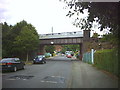
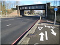
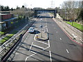
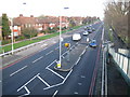
Photos of SM1 3TT


Area Information
Living in SM1 3TT means residing within a compact cluster covering just 1.5 hectares in England. This small postcode forms a distinct residential pocket where daily life revolves around close proximity to neighbours and local services rather than sprawling metropolitan distances. You are part of a community of 2,280 people, creating an environment that feels tight-knit yet functional. The area sits comfortably within the South London region, offering a balance between urban accessibility and residential quietness. Your daily routine benefits from being situated near key transport hubs and essential high-street retailers. The density of 153,498 people per square kilometre suggests a heavily populated micro-locality, which typically translates to efficient access to public services and frequent transport links. This specific postcode, SM1 3TT, serves as a base for residents who value convenience without the chaos of larger city centres. The setting supports a lifestyle where walking distances to shops and stations remain manageable, making it ideal for those who prioritise time efficiency in their day-to-day movements.
- Area Type
- Postcode
- Area Size
- 1.5 hectares
- Population
- 2280
- Population Density
- 4975 people/km²
The property market in SM1 3TT is almost exclusively owner-occupied, driven by the fact that 77 per cent of residents own their homes. This statistic signals that the local housing market functions primarily for existing owners and replacements rather than tenant-to-tenant rentals. The accommodation type is strictly houses, which shapes your buying options towards detached, semi-detached, or terraced family dwellings. Buyers looking to move into SM1 3TT enter a context where land and property values are tied to single-family structures. This contrasts with rental-heavy districts where investment yields or short-term tenancies might drive the prices. The 100 per cent prevalence of houses within the data implies that if you are seeking a specific flat or apartment configuration, this postcode does not currently offer that inventory. Instead, your search will naturally align with the established housing stock of traditional homes. This market structure supports steady capital retention, as owner-occupiers tend to be less volatile than investors seeking rapid turnover in smaller properties.
House Prices in SM1 3TT
Showing 36 properties
| Address | Type | Beds | Baths | Last Sale Price | Last Sale Date | |
|---|---|---|---|---|---|---|
| 5, Wheatcroft Court, Cleeve Way, Sutton, SM1 3TT | Flat | 2 | 2 | - | - | |
| 17, Wheatcroft Court, Cleeve Way, Sutton, SM1 3TT | Flat | 2 | 2 | - | - | |
| 25, Wheatcroft Court, Cleeve Way, Sutton, SM1 3TT | Flat | 2 | 2 | - | - | |
| 32, Wheatcroft Court, Cleeve Way, Sutton, SM1 3TT | Flat | 2 | 2 | - | - | |
| 27, Wheatcroft Court, Cleeve Way, Sutton, SM1 3TT | Flat | 2 | 2 | - | - | |
| 1, Wheatcroft Court, Cleeve Way, Sutton, SM1 3TT | Flat | 2 | 2 | - | - | |
| 6, Wheatcroft Court, Cleeve Way, Sutton, SM1 3TT | Flat | 2 | 1 | - | - | |
| 16, Wheatcroft Court, Cleeve Way, Sutton, SM1 3TT | Flat | 2 | 2 | - | - | |
| 8, Wheatcroft Court, Cleeve Way, Sutton, SM1 3TT | Flat | - | - | - | - | |
| 9, Wheatcroft Court, Cleeve Way, Sutton, SM1 3TT | Flat | - | - | - | - |
Energy Efficiency in SM1 3TT
Your lifestyle in SM1 3TT centres on convenient access to a variety of retail and transport options within practical reach. For retail needs, you are within easy distance of Lidl Rosehill, M&S St, and Tesco Angel. These three major outlets provide a full spectrum of grocery shopping and daily essentials without needing to travel far from home. Transport connectivity is equally strong, with five rail stops nearby including Sutton Common Station, St Helier Station, and Morden South. Five metro stops such as Mitcham Tram Stop and Morden also bring extra flexibility to your commuting options. Additionally, five ferry locations like Kingston Town End Pier and Wandsworth Riverside Quarter Pier are accessible, offering scenic and alternative routes for travel. This dense network of amenities ensures that travelling for work, leisure, or shopping requires minimal planning and effort. The presence of these specific venues means your daily routine benefits from variety and reliability, keeping you connected to the wider South London region effortlessly.
Amenities
Schools
Families considering SM1 3TT have one specific educational neighbour within their immediate vicinity. The nearest provision is the Anchor School, which operates under the special school category. This institution caters to students with special educational needs and disabilities, providing a tailored learning environment distinct from mainstream comprehensive or private settings. For parents, this means the local area is suited to households where a child requires specific educational support or specialised care. The absence of other mainstream primary or secondary schools in the immediate data set highlights a niche educational landscape. If your family sends young children to mainstream neighbourhood schools, you may need to look beyond the immediate perimeter of SM1 3TT. However, the presence of The Anchor School ensures that residents with specific educational requirements are well-served locally. The school type directly influences your choice of neighbourhood, making this location a practical fit for those requiring specialised educational facilities nearby.
| Rank | School | Type | Entry gender | Ages |
|---|
Explore more schools in this area
Go to Schools tabDemographics
The community within SM1 3TT is defined by a mature demographic profile. The median age sits at 47, indicating a population composed primarily of adults between 30 and 64 years old. This age range suggests a neighbourhood where families and professionals are established in their careers, likely seeking stability and permanence. Such a demographic mix often correlates with low tenancy turnover and long-term community cohesion. Homeownership stands as a dominant feature, with 77 per cent of residents owning their properties outright. This high level of ownership paints a picture of financial stability and deep roots in the locality. The predominant housing stock consists of houses, meaning you can expect a streetscape characterised by independent dwellings rather than high-rise blocks or Purpose-built flats. The ethnic makeup is predominantly White, reflecting the traditional demographic composition of this specific cluster. These facts combine to create a setting where cultural familiarity prevails, supported by a resident base that values the area's established character.
Household Size
Accommodation Type
Tenure
Ethnic Group
Religion
Household Composition
Age
Household Deprivation
NS-SEC
Explore more demographic insights in this area
Go to Demographics tabPlanning
Planning Constraints
- Flood RiskPremium
- Ramsar Wetland SitesPremium
- Area of Outstanding Natural BeautyPremium
- Protected Nature ReservePremium
- Protected WoodlandPremium