Area Overview for SM1 3JD
Photos of SM1 3JD
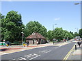
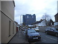
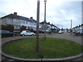
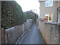
64 photos from this area
Area Information
Key information about the SM1 3JD including its size, population, and administrative classification.
- Area Type
- Postcode
- Area Size
- 1.0 hectares
- Population
- 2280
- Population Density
- 4975 people/km²
House Prices in SM1 3JD
38
Properties
£331,253
Average Sold Price
£105,000
Lowest Price
£615,625
Highest Price
Showing 38 properties
| Address | Type | Beds | Baths | Last Sale Price | Last Sale Date | |
|---|---|---|---|---|---|---|
| 65 Hurstcourt Road, Sutton, SM1 3JD | Terraced | 3 | - | £525,000 | Feb 2025 | |
| 44 Hurstcourt Road, Sutton, SM1 3JD | Terraced | 4 | 4 | £615,625 | Sep 2023 | |
| 85 Hurstcourt Road, Sutton, SM1 3JD | house | - | - | £465,000 | May 2021 | |
| 26 Hurstcourt Road, Sutton, SM1 3JD | house | - | - | £450,000 | Aug 2020 | |
| 77 Hurstcourt Road, Sutton, SM1 3JD | Terraced | 3 | 1 | £455,000 | Mar 2019 | |
| 34 Hurstcourt Road, Sutton, SM1 3JD | Terraced | 4 | 2 | £455,000 | Jun 2018 | |
| 71 Hurstcourt Road, Sutton, SM1 3JD | Terraced | 3 | 1 | £360,000 | Sep 2015 | |
| 57 Hurstcourt Road, Sutton, SM1 3JD | Terraced | 4 | - | £449,950 | Sep 2015 | |
| 59 Hurstcourt Road, Sutton, SM1 3JD | house | 3 | - | £330,000 | Apr 2015 | |
| 75 Hurstcourt Road, Sutton, SM1 3JD | Terraced | 3 | - | £341,500 | Jan 2015 |
Page 1 of 4
Energy Efficiency in SM1 3JD
Amenities
Schools
| Rank | School | Type | Entry gender | Ages |
|---|
Explore more schools in this area
Go to Schools tabDemographics
Household Size
Family (3-5 people)
most common
Accommodation Type
Houses
most common
Tenure
77
majority
Ethnic Group
White
most common
Religion
N/A
most common
Household Composition
N/A
most common
Age
47
median
Adults (30-64 years)
most common
Household Deprivation
N/A
with no deprivation
NS-SEC
35
in Lower managerial occupations
Explore more demographic insights in this area
Go to Demographics tabPlanning
Planning Constraints
- Flood RiskPremium
- Ramsar Wetland SitesPremium
- Area of Outstanding Natural BeautyPremium
- Protected Nature ReservePremium
- Protected WoodlandPremium