Area Overview for SM1 3DE
Photos of SM1 3DE
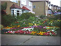
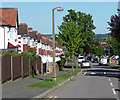
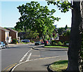
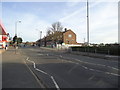
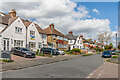
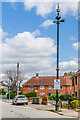
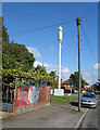
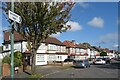

40 photos from this area
Area Information
Key information about the SM1 3DE including its size, population, and administrative classification.
- Area Type
- Postcode
- Area Size
- 8074 m²
- Population
- 1862
- Population Density
- 6795 people/km²
House Prices in SM1 3DE
34
Properties
£236,187
Average Sold Price
£40,000
Lowest Price
£360,800
Highest Price
Showing 34 properties
| Address | Type | Beds | Baths | Last Sale Price | Last Sale Date | |
|---|---|---|---|---|---|---|
| 21, Lymington Court, All Saints Road, Sutton, SM1 3DE | Maisonette | 2 | 1 | £350,000 | Mar 2025 | |
| 17, Lymington Court, All Saints Road, Sutton, SM1 3DE | Flat | 2 | 1 | £360,000 | Mar 2025 | |
| 5, Lymington Court, All Saints Road, Sutton, SM1 3DE | Maisonette | 2 | 1 | £353,000 | Nov 2024 | |
| 22, Lymington Court, All Saints Road, Sutton, SM1 3DE | Maisonette | 2 | 1 | £360,800 | Jan 2024 | |
| 14, Lymington Court, All Saints Road, Sutton, SM1 3DE | Maisonette | 2 | 1 | £340,000 | Apr 2022 | |
| 12, Lymington Court, All Saints Road, Sutton, SM1 3DE | Flat | - | - | £335,050 | Jun 2021 | |
| 4, Lymington Court, All Saints Road, Sutton, SM1 3DE | Flat | 2 | 1 | £335,000 | Dec 2020 | |
| 33, Lymington Court, All Saints Road, Sutton, SM1 3DE | Maisonette | 2 | 1 | £355,000 | Oct 2020 | |
| 34, Lymington Court, All Saints Road, Sutton, SM1 3DE | Maisonette | - | - | £325,000 | Feb 2019 | |
| 31, Lymington Court, All Saints Road, Sutton, SM1 3DE | Flat | - | - | £325,000 | Apr 2018 |
Page 1 of 4
Energy Efficiency in SM1 3DE
Amenities
Schools
| Rank | School | Type | Entry gender | Ages |
|---|
Explore more schools in this area
Go to Schools tabDemographics
Household Size
Family (3-5 people)
most common
Accommodation Type
Flats
most common
Tenure
69
majority
Ethnic Group
White
most common
Religion
N/A
most common
Household Composition
N/A
most common
Age
47
median
Adults (30-64 years)
most common
Household Deprivation
N/A
with no deprivation
NS-SEC
34
in Lower managerial occupations
Explore more demographic insights in this area
Go to Demographics tabPlanning
Planning Constraints
- Flood RiskPremium
- Ramsar Wetland SitesPremium
- Area of Outstanding Natural BeautyPremium
- Protected Nature ReservePremium
- Protected WoodlandPremium