Area Overview for SM1 2NX
Photos of SM1 2NX
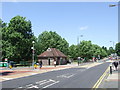
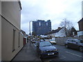
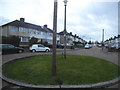
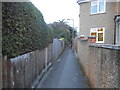
64 photos from this area
Area Information
Key information about the SM1 2NX including its size, population, and administrative classification.
- Area Type
- Postcode
- Area Size
- 2.1 hectares
- Population
- 1818
- Population Density
- 7740 people/km²
House Prices in SM1 2NX
68
Properties
£279,680
Average Sold Price
£57,331
Lowest Price
£612,500
Highest Price
Showing 68 properties
| Address | Type | Beds | Baths | Last Sale Price | Last Sale Date | |
|---|---|---|---|---|---|---|
| 302 Collingwood Road, Sutton, SM1 2NX | Terraced | 4 | 2 | £612,500 | Jul 2025 | |
| 292 Collingwood Road, Sutton, SM1 2NX | Semi-detached | 2 | 1 | £425,000 | Jan 2024 | |
| 294 Collingwood Road, Sutton, SM1 2NX | Semi-detached | 2 | 1 | £440,900 | Oct 2023 | |
| 196 Collingwood Road, Sutton, SM1 2NX | Terraced | 2 | 1 | £396,000 | Nov 2022 | |
| 206 Collingwood Road, Sutton, SM1 2NX | house | - | - | £390,000 | Nov 2021 | |
| 244B Collingwood Road, Sutton, SM1 2NX | Flat | 1 | 1 | £247,500 | Apr 2021 | |
| 260 Collingwood Road, Sutton, SM1 2NX | Semi-detached | 2 | 1 | £420,000 | Feb 2020 | |
| 268 Collingwood Road, Sutton, SM1 2NX | Semi-detached | 2 | 1 | £380,000 | Jan 2020 | |
| 276 Collingwood Road, Sutton, SM1 2NX | Maisonette | 2 | 1 | £335,950 | Oct 2019 | |
| 218A Collingwood Road, Sutton, SM1 2NX | Terraced | 3 | 2 | £260,000 | Nov 2018 |
Page 1 of 7
Energy Efficiency in SM1 2NX
Amenities
Schools
| Rank | School | Type | Entry gender | Ages |
|---|
Explore more schools in this area
Go to Schools tabDemographics
Household Size
Family (3-5 people)
most common
Accommodation Type
Houses
most common
Tenure
51
majority
Ethnic Group
White
most common
Religion
N/A
most common
Household Composition
N/A
most common
Age
47
median
Adults (30-64 years)
most common
Household Deprivation
N/A
with no deprivation
NS-SEC
30
in Lower managerial occupations
Explore more demographic insights in this area
Go to Demographics tabPlanning
Planning Constraints
- Flood RiskPremium
- Ramsar Wetland SitesPremium
- Area of Outstanding Natural BeautyPremium
- Protected Nature ReservePremium
- Protected WoodlandPremium