Area Overview for SM1 2LR
Photos of SM1 2LR
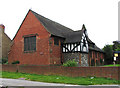
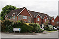
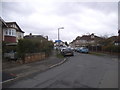
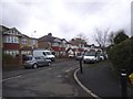
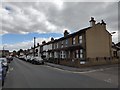
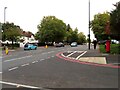
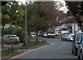
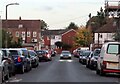
34 photos from this area
Area Information
Key information about the SM1 2LR including its size, population, and administrative classification.
- Area Type
- Postcode
- Area Size
- 2.5 hectares
- Population
- 1518
- Population Density
- 4648 people/km²
House Prices in SM1 2LR
12
Properties
£352,767
Average Sold Price
£135,000
Lowest Price
£575,000
Highest Price
Showing 12 properties
| Address | Type | Beds | Baths | Last Sale Price | Last Sale Date | |
|---|---|---|---|---|---|---|
| 161 St Dunstans Hill, Cheam, SM1 2LR | Detached | 2 | 1 | £500,000 | Dec 2025 | |
| 167 St Dunstans Hill, Cheam, SM1 2LR | Terraced | 2 | 1 | £410,000 | Jun 2025 | |
| 171A St Dunstans Hill, Cheam, SM1 2LR | Terraced | 1 | 1 | £330,000 | Oct 2023 | |
| 175 St Dunstans Hill, Cheam, SM1 2LR | Retail | 3 | 2 | £575,000 | Aug 2022 | |
| 169 St Dunstans Hill, Cheam, SM1 2LR | house | - | - | £347,000 | Apr 2021 | |
| 171 St Dunstans Hill, Cheam, SM1 2LR | Terraced | 2 | 1 | £349,950 | Feb 2018 | |
| 165 St Dunstans Hill, Cheam, SM1 2LR | Terraced | 2 | - | £205,000 | Jan 2011 | |
| 159 St Dunstans Hill, Cheam, SM1 2LR | Detached | - | - | £322,950 | May 2008 | |
| 173 St Dunstans Hill, Cheam, SM1 2LR | Terraced | - | - | £135,000 | May 2001 | |
| Your Spaces, Seears Park Nursery And Tea Rooms, Seears Park, St Dunstans Hill, Cheam, SM1 2LR | restaurant_cafe | - | - | - | - |
Page 1 of 2
Energy Efficiency in SM1 2LR
Amenities
Schools
| Rank | School | Type | Entry gender | Ages |
|---|
Explore more schools in this area
Go to Schools tabDemographics
Household Size
Family (3-5 people)
most common
Accommodation Type
Houses
most common
Tenure
79
majority
Ethnic Group
White
most common
Religion
N/A
most common
Household Composition
N/A
most common
Age
47
median
Adults (30-64 years)
most common
Household Deprivation
N/A
with no deprivation
NS-SEC
39
in Lower managerial occupations
Explore more demographic insights in this area
Go to Demographics tabPlanning
Planning Constraints
- Flood RiskPremium
- Ramsar Wetland SitesPremium
- Area of Outstanding Natural BeautyPremium
- Protected Nature ReservePremium
- Protected WoodlandPremium