Area Overview for SM1 2JA
Photos of SM1 2JA

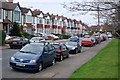
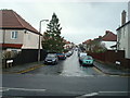
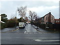
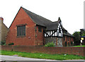
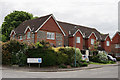
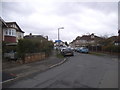
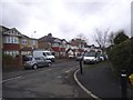
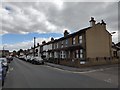
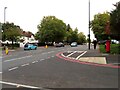
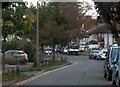
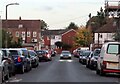
34 photos from this area
Area Information
Key information about the SM1 2JA including its size, population, and administrative classification.
- Area Type
- Postcode
- Area Size
- 1.7 hectares
- Population
- 1518
- Population Density
- 4648 people/km²
House Prices in SM1 2JA
49
Properties
£381,892
Average Sold Price
£79,500
Lowest Price
£690,000
Highest Price
Showing 49 properties
| Address | Type | Beds | Baths | Last Sale Price | Last Sale Date | |
|---|---|---|---|---|---|---|
| 41 Hilldale Road, Cheam, SM1 2JA | Semi-detached | 4 | 1 | £680,000 | Mar 2025 | |
| 23 Hilldale Road, Cheam, SM1 2JA | Bungalow | 2 | 1 | £485,000 | Oct 2024 | |
| 1D Hilldale Road, Cheam, SM1 2JA | Terraced | 3 | 1 | £540,000 | Jun 2024 | |
| 47 Hilldale Road, Cheam, SM1 2JA | Semi-detached | 3 | 1 | £520,000 | May 2024 | |
| 75 Hilldale Road, Cheam, SM1 2JA | Semi-detached | 3 | 1 | £525,000 | Apr 2024 | |
| 55 Hilldale Road, Cheam, SM1 2JA | house | - | - | £300,000 | Nov 2023 | |
| 57 Hilldale Road, Cheam, SM1 2JA | Semi-detached | 4 | 2 | £610,000 | Apr 2023 | |
| 45 Hilldale Road, Cheam, SM1 2JA | house | 2 | 2 | £491,500 | Mar 2023 | |
| 43 Hilldale Road, Cheam, SM1 2JA | house | - | - | £595,000 | Mar 2023 | |
| 29 Hilldale Road, Cheam, SM1 2JA | house | - | - | £550,000 | Sep 2021 |
Page 1 of 5
Energy Efficiency in SM1 2JA
Amenities
Schools
| Rank | School | Type | Entry gender | Ages |
|---|
Explore more schools in this area
Go to Schools tabDemographics
Household Size
Family (3-5 people)
most common
Accommodation Type
Houses
most common
Tenure
79
majority
Ethnic Group
White
most common
Religion
N/A
most common
Household Composition
N/A
most common
Age
47
median
Adults (30-64 years)
most common
Household Deprivation
N/A
with no deprivation
NS-SEC
39
in Lower managerial occupations
Explore more demographic insights in this area
Go to Demographics tabPlanning
Planning Constraints
- Flood RiskPremium
- Ramsar Wetland SitesPremium
- Area of Outstanding Natural BeautyPremium
- Protected Nature ReservePremium
- Protected WoodlandPremium