Area Overview for SM1 2DY
Photos of SM1 2DY

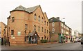
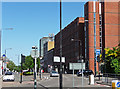
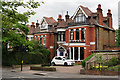

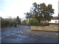


36 photos from this area
Area Information
Key information about the SM1 2DY including its size, population, and administrative classification.
- Area Type
- Postcode
- Area Size
- 6878 m²
- Population
- 2018
- Population Density
- 9707 people/km²
House Prices in SM1 2DY
66
Properties
£203,279
Average Sold Price
£55,000
Lowest Price
£330,000
Highest Price
Showing 66 properties
| Address | Type | Beds | Baths | Last Sale Price | Last Sale Date | |
|---|---|---|---|---|---|---|
| 119 Homefield Park, Sutton, SM1 2DY | Flat | - | - | £326,000 | Apr 2025 | |
| 135 Homefield Park, Sutton, SM1 2DY | Flat | 2 | 1 | £247,500 | Mar 2025 | |
| 79 Homefield Park, Sutton, SM1 2DY | Flat | 2 | - | £330,000 | Nov 2024 | |
| 131 Homefield Park, Sutton, SM1 2DY | Flat | - | - | £325,000 | Jun 2024 | |
| 76 Homefield Park, Sutton, SM1 2DY | Flat | - | - | £240,000 | May 2022 | |
| 85 Homefield Park, Sutton, SM1 2DY | Flat | - | - | £310,000 | Oct 2021 | |
| 86 Homefield Park, Sutton, SM1 2DY | Flat | - | - | £237,500 | Aug 2021 | |
| 87 Homefield Park, Sutton, SM1 2DY | Flat | - | - | £314,000 | Jun 2021 | |
| 95 Homefield Park, Sutton, SM1 2DY | Flat | - | - | £321,000 | Jun 2021 | |
| 121 Homefield Park, Sutton, SM1 2DY | Flat | - | - | £320,000 | Jun 2021 |
Page 1 of 7
Energy Efficiency in SM1 2DY
Amenities
Schools
| Rank | School | Type | Entry gender | Ages |
|---|
Explore more schools in this area
Go to Schools tabDemographics
Household Size
One person
most common
Accommodation Type
Flats
most common
Tenure
38
majority
Ethnic Group
White
most common
Religion
N/A
most common
Household Composition
N/A
most common
Age
47
median
Adults (30-64 years)
most common
Household Deprivation
N/A
with no deprivation
NS-SEC
43
in Lower managerial occupations
Explore more demographic insights in this area
Go to Demographics tabPlanning
Planning Constraints
- Flood RiskPremium
- Ramsar Wetland SitesPremium
- Area of Outstanding Natural BeautyPremium
- Protected Nature ReservePremium
- Protected WoodlandPremium