Area Overview for SM1 2BU
Photos of SM1 2BU
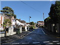
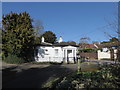
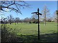
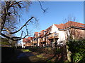
91 photos from this area
Area Information
Key information about the SM1 2BU including its size, population, and administrative classification.
- Area Type
- Postcode
- Area Size
- 1.7 hectares
- Population
- 1295
- Population Density
- 4954 people/km²
House Prices in SM1 2BU
34
Properties
£397,457
Average Sold Price
£106,900
Lowest Price
£752,000
Highest Price
Showing 34 properties
| Address | Type | Beds | Baths | Last Sale Price | Last Sale Date | |
|---|---|---|---|---|---|---|
| 41 Summerville Gardens, Cheam, SM1 2BU | Semi-detached | 3 | 1 | £590,000 | Sep 2020 | |
| 21 Summerville Gardens, Cheam, SM1 2BU | Semi-detached | 4 | 1 | £650,000 | May 2019 | |
| 57 Summerville Gardens, Cheam, SM1 2BU | Semi-detached | 4 | 2 | £752,000 | May 2019 | |
| 39 Summerville Gardens, Cheam, SM1 2BU | Semi-detached | 3 | 1 | £575,000 | Apr 2019 | |
| 19 Summerville Gardens, Cheam, SM1 2BU | Semi-detached | 3 | 1 | £620,000 | Aug 2018 | |
| 59 Summerville Gardens, Cheam, SM1 2BU | house | 3 | 1 | £567,000 | Oct 2016 | |
| 7 Summerville Gardens, Cheam, SM1 2BU | house | - | - | £585,000 | Apr 2016 | |
| 51 Summerville Gardens, Cheam, SM1 2BU | Semi-detached | 3 | 1 | £552,500 | Sep 2015 | |
| 47 Summerville Gardens, Cheam, SM1 2BU | Semi-detached | 4 | 2 | £599,000 | Apr 2015 | |
| 67 Summerville Gardens, Cheam, SM1 2BU | Semi-detached | 3 | 1 | £530,000 | Dec 2014 |
Page 1 of 4
Energy Efficiency in SM1 2BU
Amenities
Schools
| Rank | School | Type | Entry gender | Ages |
|---|
Explore more schools in this area
Go to Schools tabDemographics
Household Size
Family (3-5 people)
most common
Accommodation Type
Houses
most common
Tenure
93
majority
Ethnic Group
White
most common
Religion
N/A
most common
Household Composition
N/A
most common
Age
47
median
Adults (30-64 years)
most common
Household Deprivation
N/A
with no deprivation
NS-SEC
53
in Lower managerial occupations
Explore more demographic insights in this area
Go to Demographics tabPlanning
Planning Constraints
- Flood RiskPremium
- Ramsar Wetland SitesPremium
- Area of Outstanding Natural BeautyPremium
- Protected Nature ReservePremium
- Protected WoodlandPremium