Area Overview for Slade Green & Northend Ward
Photos of Slade Green & Northend Ward

Area Information
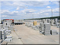
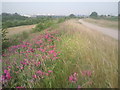
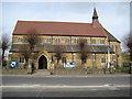
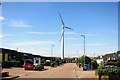
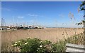
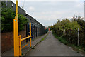
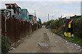
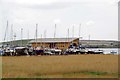
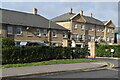
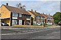
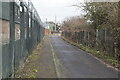
The Slade Green & Northend Ward occupies a distinctive position within the London Borough of Bexley, covering exactly 5.5 km² of Greater London. You will find that this small district contains around 5,156 residents, creating a density of 930 people per square kilometre. The area encompasses the familiar suburbs of Slade Green and North End, situated northeast of Bexleyheath and northwest of Dartford. Its location places you near both the River Thames and the River Darent, offering proximity to significant waterways without a rural retreat. This ward carries deep historical roots, with evidence from the Palaeolithic era and medieval mentions in the Domesday Book. The Victorian era transformed the locality, establishing a National School in 1868 and St Augustine's Church in 1899. Edwardian expansion followed the arrival of the railway in 1900, which opened a depot and station that still serve the community today. The former Thames Munition Works site now functions as the Darent Industrial Estate, reflecting the area's industrial past. Life here blends historical significance with modern suburbia. You see locally listed buildings such as the former Railway Tavern and Oak Road, a conservation area featuring 1900 railway workers' cottages. The landscape includes train sheds and farmsteads like the Grange and Cottages at Howbury. Whether you seek homes in Slade Green or wish to explore schools near Slade Green, the area offers a compact neighbourhood where history and daily living intersect.
- Area Type
- District Borough Unitary Ward
- Area Size
- 5.5 km²
- Population
- 5156
- Population Density
- 930 people/km²
Demographics
You will find that the community in Slade Green & Northend Ward has an older population profile, with a median age of 70. While the specific predominant age group data is not itemised beyond the total count, this high median suggests a settlement with many long-term residents. Home ownership stands at exactly 50%, meaning half of the households own their property outright or with a mortgage, while the other half rent. The ward contains 5,156 people spread across its 5.5 km² footprint, resulting in a population density of 930 people per square kilometre. This density indicates a reasonably packed residential environment where neighbours are close by. Data regarding ethnic diversity, household composition breakdowns, specific accommodation types beyond the total count, and religious demographics are not available in the provided figures. Residents can expect a neighbourhood where half the homes are owner-occupied, providing stability. The area does not show specific data on whether the housing stock consists primarily of detached, semi-detached, terraced, or flats. Without detailed breakdowns of household types, one cannot assume a specific family structure or single-person prevalence beyond the aggregate population count. The community remains a significant part of the Greater London demographic, deeply rooted in the local history and industrial heritage of the borough.
Household Size
Accommodation Type
Tenure
Ethnic Group
Religion
Household Composition
Age
Household Deprivation
NS-SEC
Explore more demographic insights in this area
Go to Demographics tabPlanning
Planning Constraints
- Flood RiskPremium
- Ramsar Wetland SitesPremium
- Area of Outstanding Natural BeautyPremium
- Protected Nature ReservePremium
- Protected WoodlandPremium
- Crime RiskPremium