Area Overview for Selsdon Vale & Forestdale Ward
Photos of Selsdon Vale & Forestdale Ward
Area Information
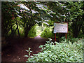
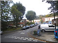
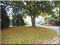
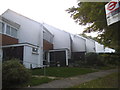
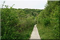
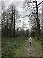
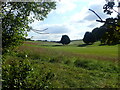
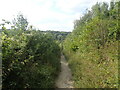
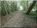
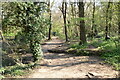
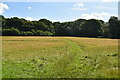
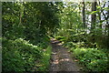
Selsdon Vale & Forestdale Ward sits within the London Borough of Croydon, covering a compact area of 4.9 km². Historically known as Croydon Crook, this suburban district developed significantly in the 20th century. Selsdon Garden Village appeared in the 1920s, followed by Monks Hill in the 1940s and Forestdale in the 1960s. The landscape is defined by curved streets of housing estates designed with conservation in mind. Residents access local centres in Selsdon, Addington Village, and Forestdale for shops and services. The ward includes Selsdon Wood, a nature reserve preserved through public appeal and managed on a long-term lease. This green space stands alongside the historic Selsdon Park Hotel, formerly the main estate house and site of Croydon High School. Living in Selsdon Vale & Forestdale means engaging with a residential setting rooted in early garden village principles. The population of around 1,439 gives the area a tightly knit feel despite its location within Greater London. The mix of historical estates and modern suburban development creates a defined character. You will find yourself in a district where planning was prioritised from the outset. The area remains a functional part of the broader Selsdon community today.
- Area Type
- District Borough Unitary Ward
- Area Size
- 4.9 km²
- Population
- Not available
- Population Density
- Not available
Demographics
The community in Selsdon Vale & Forestdale Ward is notably mature, with a median age of 70. This demographic profile suggests an area suited for retirees and established residents rather than young families or students. The most common age range is recorded simply as 'Age: Total', indicating that the entire population skew is towards older demographics. Home ownership is extremely high, standing at 82% within the ward. This figure confirms that the majority of people living here own their properties outright or have significant equity. Household composition and predominant ethnic group data are listed as totals in the available records, meaning these specific breakdowns are not detailed in the current dataset. Religion data is also listed as a general total without a specific dominant group highlighted. You can expect a neighbourhood where ownership is the norm. The high percentage suggests stability and long-term settlement patterns. There is no indication of a transient or rental-heavy population in this ward. The social fabric reflects this stability with very few privately rented homes. This demographic reality shapes the local daily life and community engagement in Selsdon Vale & Forestdale.
Household Size
Accommodation Type
Tenure
Ethnic Group
Religion
Household Composition
Age
Household Deprivation
NS-SEC
Explore more demographic insights in this area
Go to Demographics tabPlanning
Planning Constraints
- Flood RiskPremium
- Ramsar Wetland SitesPremium
- Area of Outstanding Natural BeautyPremium
- Protected Nature ReservePremium
- Protected WoodlandPremium