Area Overview for Selsdon & Addington Village Ward
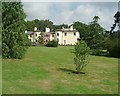
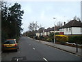
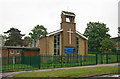
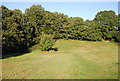
Photos of Selsdon & Addington Village Ward
Area Information
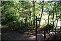
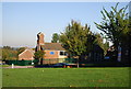
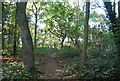
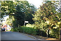
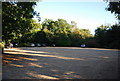
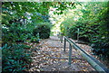
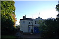
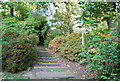
The Selsdon & Addington Village Ward sits within the London Borough of Croydon, covering 5.2 square kilometres. This south London area combines two distinct settlements with deep historical roots. You will find that Selsdon originated as part of the historic Selsdon Park Estate, while Addington dates back to Saxon origins. The ward was formed in 2018 by merging former electoral divisions, yet the two villages retain their separate identities. Today, approximately 1,600 people call this ward home. The population stands at around 1,617 residents living in a relatively compact space. Daily life here balances village tranquillity with access to broader London facilities. The area is characterised by Selsdon Wood, a nature reserve managed by the National Trust and Croydon Council, where five large meadows are surrounded by woodland. You will also find Addington Village Conservation Area, which preserves the historical character of the settlement. The name Addington derives from "Addan-tun," meaning Ada's farm, a fact recorded in the Domesday Book. Modern Selsdon began developing in 1925 through the Selsdon Garden Village estate. This planned community was built on greenfield land miles from existing suburbia at the time. The first houses were occupied in September 1925, followed by shops and a school. This history is visible in the boundary stones marking Croydon's expansion in 1928. Whether you are looking at homes in Selsdon & Addington Village Ward or visiting for the first time, you encounter a setting shaped by both medieval history and 20th-century planning. The area feels separate from the citycentre but remains within Greater London. Understanding this ward means recognising its specific layout, from the ancient hedges around Selsdon Wood to the visible boundary markers near Littleath Wood.
- Area Type
- District Borough Unitary Ward
- Area Size
- 5.2 km²
- Population
- 1617
- Population Density
- 310 people/km²
Demographics
The community in Selsdon & Addington Village Ward suits those seeking a quieter lifestyle. The median age is 70 years, indicating a population skewed considerably towards older residents. This age profile reflects a district that has served as a retirement or semi-retirement location for many decades. You will find that roughly three-quarters, or 75%, of households here own their homes outright or have a mortgage. This high percentage suggests a stable community where residents have long-term ties to their localities. The area does not show specific data regarding ethnic diversity or predominant religious groups in the provided records. Where figures are available, the population density is 310 people per square kilometre, which remains moderate for a London borough. Historical records note that in 1792, Count Daniel Lyson recorded 132 people living in the village of Addington. The modern housing stock largely predates modern diversity trends, aligning with the median age figure. The household composition data is recorded generally without a breakdown of single-person versus multi-generational homes. When considering living in Selsdon & Addington Village Ward, understand that the demographic structure is historically formed rather than rapidly changing. The area attracted families when the Garden Village was built, but time has shifted the centre of gravity. The high home ownership rate supports a stable environment. You should also note that the total population figure fluctuates slightly between sources, with some citing approximately 1,603 while others record 1,617. These minor variations do not alter the fundamental picture of a small, primarily owner-occupied community with an older demographic core.
Household Size
Accommodation Type
Tenure
Ethnic Group
Religion
Household Composition
Age
Household Deprivation
NS-SEC
Explore more demographic insights in this area
Go to Demographics tabPlanning
Planning Constraints
- Flood RiskPremium
- Ramsar Wetland SitesPremium
- Area of Outstanding Natural BeautyPremium
- Protected Nature ReservePremium
- Protected WoodlandPremium