Area Overview for SE9 6RT
Photos of SE9 6RT
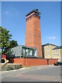

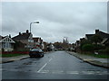
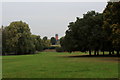
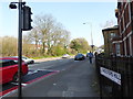
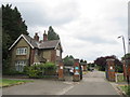

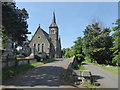
100 photos from this area
Area Information
Key information about the SE9 6RT including its size, population, and administrative classification.
- Area Type
- Postcode
- Area Size
- 2.4 hectares
- Population
- 1721
- Population Density
- 4131 people/km²
House Prices in SE9 6RT
22
Properties
£319,850
Average Sold Price
£82,000
Lowest Price
£535,000
Highest Price
Showing 22 properties
| Address | Type | Beds | Baths | Last Sale Price | Last Sale Date | |
|---|---|---|---|---|---|---|
| 92 Dunblane Road, Eltham, SE9 6RT | Semi-detached | 3 | 2 | £535,000 | Dec 2024 | |
| 68 Dunblane Road, Eltham, SE9 6RT | Semi-detached | 3 | 1 | £522,000 | Apr 2024 | |
| 84 Dunblane Road, Eltham, SE9 6RT | Semi-detached | 3 | 1 | £530,000 | Mar 2024 | |
| 80 Dunblane Road, Eltham, SE9 6RT | Semi-detached | 3 | 2 | £509,000 | Aug 2022 | |
| 90 Dunblane Road, Eltham, SE9 6RT | Semi-detached | 4 | 2 | £402,500 | Jul 2019 | |
| 94 Dunblane Road, Eltham, SE9 6RT | Semi-detached | 3 | 2 | £450,000 | Jul 2016 | |
| 64 Dunblane Road, Eltham, SE9 6RT | Semi-detached | 3 | - | £270,000 | Mar 2014 | |
| 72 Dunblane Road, Eltham, SE9 6RT | Semi-detached | 3 | - | £222,500 | Apr 2012 | |
| 66 Dunblane Road, Eltham, SE9 6RT | house | - | - | £249,950 | Aug 2011 | |
| 56 Dunblane Road, Eltham, SE9 6RT | house | - | - | £250,000 | Jun 2011 |
Page 1 of 3
Energy Efficiency in SE9 6RT
Amenities
Schools
| Rank | School | Type | Entry gender | Ages |
|---|
Explore more schools in this area
Go to Schools tabDemographics
Household Size
Family (3-5 people)
most common
Accommodation Type
Houses
most common
Tenure
60
majority
Ethnic Group
White
most common
Religion
N/A
most common
Household Composition
N/A
most common
Age
47
median
Adults (30-64 years)
most common
Household Deprivation
N/A
with no deprivation
NS-SEC
47
in Lower managerial occupations
Explore more demographic insights in this area
Go to Demographics tabPlanning
Planning Constraints
- Flood RiskPremium
- Ramsar Wetland SitesPremium
- Area of Outstanding Natural BeautyPremium
- Protected Nature ReservePremium
- Protected WoodlandPremium