Area Overview for SE9 6QR
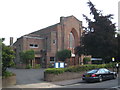
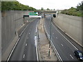
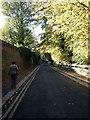
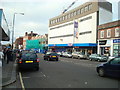
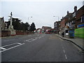
Photos of SE9 6QR


Area Information
The postcode SE9 6QR covers a specific residential cluster in England, home to a total population of 1582. Living in this small neighbourhood offers a tight-knit environment where residents know their surroundings. It is a compact area within a larger local government district, meaning you travel short distances to access the wider opportunities of South East London. The scale of the neighbourhood suggests a quiet, established locality rather than a sprawling development. This particular spot avoids major industrial zones or large commercial hubs, focusing instead on living spaces. You do not have to navigate through heavy traffic congestion within the postcode limits to reach daily essentials. The area sits near significant transport links, including railways, the DLR, and ferry terminals, yet retains a residential pace. If you are considering homes in SE9 6QR, you find a setting defined by its modest size and its position near major travel arteries like London City Airport. It is a place where the convenience of the city centre is minutes away, but the day-to-day routine happens in a very manageable, localized bubble. You can walk to nearby stations in Eltham or Mottingham, or take a short trip via the Elverson Road station. This balance makes SE9 6QR a practical choice for those who value proximity to transport without the density of central zones.
- Area Type
- Postcode
- Area Size
- Not available
- Population
- 1582
- Population Density
- 6068 people/km²
SE9 6QR presents a specific housing landscape dominated by houses. With accommodation type listed clearly as houses, you will not find high-rise blocks or modern apartment complexes within this postcode boundary. The home ownership percentage sits at 48%, revealing that a significant portion of the street is rented, while nearly half of the houses have been bought by their occupants. This balance suggests a market where buying a home remains a major decision, and rental options remain plentiful for those who prefer flexibility. The total population of 1582 is small enough that inventory levels may fluctuate, yet large enough to support a local real estate turnover. Buyers considering homes in SE9 6QR should expect traditional property types rather than modern developments designed for high-density living. The 48% ownership rate indicates a mature market where resale values might be influenced by longer-term trends rather than rapid speculator activity. If you are renting, the abundance of houses offers more space than typical city flats. For purchasers, the lower density of the area compared to central London offers privacy and grounds, though you may have less access to on-site amenities within the immediate cluster. The mix of owner-occupiers and renters typically creates a stable demand for maintenance and improvements across the area.
House Prices in SE9 6QR
No properties found in this postcode.
Energy Efficiency in SE9 6QR
Residents of SE9 6QR have access to a practical range of amenities within practical walking or driving distance. For shopping needs, you can visit Co-op Westhorne, Tesco Eltham High, and Co-op Well. These retailers are located nearby and offer daily necessities within minutes of the postcode boundary. If you need to shop weekly, Tesco Eltham High provides a large supermarket selection, while the Co-op branches offer convenient top-ups. Transport links integrate seamlessly into this lifestyle, with five nearby rail stations including Eltham, Mottingham, and Kidbrooke. The DLR system provides access via Elverson Road and Cutty Sark stations. You also have two ferry options: Barrier Gardens Pier and Woolwich Ferry North Pier connect you across the river, with Greenwich Pier serving the south bank. London City Airport lies one unit away in the surrounding count, making international travel accessible. This density of transport means you can commute by train, DLR, bus, or boat depending on your destination. The presence of London City Airport highlights the area's proximity to a major business hub. For leisure, the Cutty Sark DLR Station offers access to the historic ship and the maritime quarter. This variety allows you to mix daily errands with short trips to cultural sites without engaging in long journeys.
Amenities
Schools
Families living in SE9 6QR have several educational institutions nearby to choose from. Haimo Primary School sits close by and holds an Ofsted rating of good. This is a state-funded primary school that serves the local catchment area. For children requiring special education needs or alternative provision, Wize Up is situated nearby. This special school also carries an Ofsted rating of good, ensuring a standardized quality of support for students with specific requirements. The presence of these two schools with good ratings provides a solid educational foundation for residents. You do not have to travel far for a primary education, as Haimo Primary School serves the immediate vicinity. The inclusion of a special school means the area caters to a diverse range of learning requirements, not just academic performance. This mix of a standard primary and a special education facility means the local system is equipped to handle various developmental needs. If you are moving to SE9 6QR with school-aged children, you secure access to regulated, inspected education without long commutes. The fact that both institutions hold good ratings suggests consistent standards in teaching and care across the different types of learners present in the area.
| Rank | School | Type | Entry gender | Ages |
|---|
Explore more schools in this area
Go to Schools tabDemographics
The community within SE9 6QR reflects the typical adult life stage, with a median age of 47 years. The most common age range consists of adults aged between 30 and 64 years, indicating that families and established professionals dominate the local scene. Home ownership stands at 48%, which places the area in a mixed market where nearly half of the residents have their own homes. The remaining residents likely rent, contributing to a stable yet varied household dynamic. Houses form the primary accommodation type, meaning you will find standalone properties rather than blocks of flats or purpose-built apartment blocks. The predominant ethnic group is White, shaping the cultural character of the neighbourhood. There is no indication of significant deprivation affecting this specific cluster in the provided records. The age profile suggests lower energy consumption compared to younger cohorts, yet high employability and stability. This demographic composition supports local services that cater to grown-up lifestyles rather than child-centric entertainment alone. When looking at schools near SE9 6QR, the demand aligns well with the parents and guardians living here. The mix of home owners and renters creates a neighbourhood where property values likely remain steady, appealing to buyers seeking a settled community rather than a transient population.
Household Size
Accommodation Type
Tenure
Ethnic Group
Religion
Household Composition
Age
Household Deprivation
NS-SEC
Explore more demographic insights in this area
Go to Demographics tabPlanning
Planning Constraints
- Flood RiskPremium
- Ramsar Wetland SitesPremium
- Area of Outstanding Natural BeautyPremium
- Protected Nature ReservePremium
- Protected WoodlandPremium