Area Overview for SE9 6NY
Photos of SE9 6NY
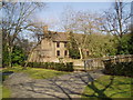
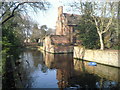
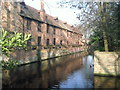
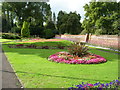
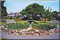
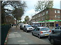
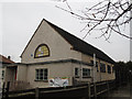
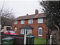
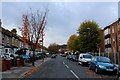
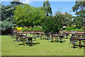
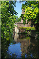
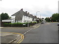
97 photos from this area
Area Information
Key information about the SE9 6NY including its size, population, and administrative classification.
- Area Type
- Postcode
- Area Size
- 7239 m²
- Population
- 1628
- Population Density
- 7255 people/km²
House Prices in SE9 6NY
24
Properties
£260,392
Average Sold Price
£115,000
Lowest Price
£437,000
Highest Price
Showing 24 properties
| Address | Type | Beds | Baths | Last Sale Price | Last Sale Date | |
|---|---|---|---|---|---|---|
| 33 Appleton Road, Eltham, SE9 6NY | Semi-detached | 3 | 1 | £417,000 | Feb 2024 | |
| 45 Appleton Road, Eltham, SE9 6NY | Semi-detached | 2 | - | £437,000 | Aug 2022 | |
| 39 Appleton Road, Eltham, SE9 6NY | house | - | - | £375,000 | Oct 2018 | |
| 27 Appleton Road, Eltham, SE9 6NY | Semi-detached | 3 | 2 | £375,000 | Mar 2017 | |
| 47 Appleton Road, Eltham, SE9 6NY | Semi-detached | 3 | 1 | £299,500 | Jan 2016 | |
| 35 Appleton Road, Eltham, SE9 6NY | Semi-detached | 3 | 1 | £275,000 | Oct 2014 | |
| 41 Appleton Road, Eltham, SE9 6NY | house | - | - | £249,995 | Aug 2008 | |
| 53 Appleton Road, Eltham, SE9 6NY | Semi-detached | 3 | 1 | £203,000 | Jun 2008 | |
| 21 Appleton Road, Eltham, SE9 6NY | Semi-detached | 3 | 1 | £226,000 | Sep 2007 | |
| 9 Appleton Road, Eltham, SE9 6NY | Semi-detached | - | - | £179,995 | Sep 2005 |
Page 1 of 3
Energy Efficiency in SE9 6NY
Amenities
Schools
| Rank | School | Type | Entry gender | Ages |
|---|
Explore more schools in this area
Go to Schools tabDemographics
Household Size
Family (3-5 people)
most common
Accommodation Type
Houses
most common
Tenure
54
majority
Ethnic Group
White
most common
Religion
N/A
most common
Household Composition
N/A
most common
Age
47
median
Adults (30-64 years)
most common
Household Deprivation
N/A
with no deprivation
NS-SEC
33
in Lower managerial occupations
Explore more demographic insights in this area
Go to Demographics tabPlanning
Planning Constraints
- Flood RiskPremium
- Ramsar Wetland SitesPremium
- Area of Outstanding Natural BeautyPremium
- Protected Nature ReservePremium
- Protected WoodlandPremium