Area Overview for SE9 5SQ
Photos of SE9 5SQ

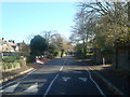
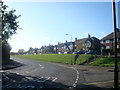
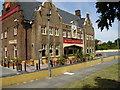
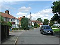
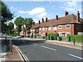
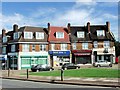
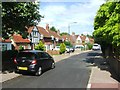
100 photos from this area
Area Information
Key information about the SE9 5SQ including its size, population, and administrative classification.
- Area Type
- Postcode
- Area Size
- 4424 m²
- Population
- 1575
- Population Density
- 3624 people/km²
House Prices in SE9 5SQ
20
Properties
£219,142
Average Sold Price
£135,000
Lowest Price
£330,000
Highest Price
Showing 20 properties
| Address | Type | Beds | Baths | Last Sale Price | Last Sale Date | |
|---|---|---|---|---|---|---|
| 214 Middle Park Avenue, Eltham, SE9 5SQ | Maisonette | 3 | - | £300,000 | Feb 2022 | |
| 250 Middle Park Avenue, Eltham, SE9 5SQ | Maisonette | 3 | 1 | £330,000 | Oct 2021 | |
| 218 Middle Park Avenue, Eltham, SE9 5SQ | Flat | - | - | £300,000 | Feb 2016 | |
| 230 Middle Park Avenue, Eltham, SE9 5SQ | Flat | - | - | £156,000 | Nov 2010 | |
| 228 Middle Park Avenue, Eltham, SE9 5SQ | Flat | - | - | £159,995 | Aug 2007 | |
| 234 Middle Park Avenue, Eltham, SE9 5SQ | Flat | - | - | £153,000 | Dec 2005 | |
| 226 Middle Park Avenue, Eltham, SE9 5SQ | Flat | - | - | £135,000 | Jun 2004 | |
| 236 Middle Park Avenue, Eltham, SE9 5SQ | Maisonette | 3 | 1 | - | - | |
| 248 Middle Park Avenue, Eltham, SE9 5SQ | Flat | - | - | - | - | |
| 246 Middle Park Avenue, Eltham, SE9 5SQ | Flat | - | - | - | - |
Page 1 of 2
Energy Efficiency in SE9 5SQ
Amenities
Schools
| Rank | School | Type | Entry gender | Ages |
|---|
Explore more schools in this area
Go to Schools tabDemographics
Household Size
Family (3-5 people)
most common
Accommodation Type
Flats
most common
Tenure
30
majority
Ethnic Group
White
most common
Religion
N/A
most common
Household Composition
N/A
most common
Age
47
median
Adults (30-64 years)
most common
Household Deprivation
N/A
with no deprivation
NS-SEC
22
in Lower managerial occupations
Explore more demographic insights in this area
Go to Demographics tabPlanning
Planning Constraints
- Flood RiskPremium
- Ramsar Wetland SitesPremium
- Area of Outstanding Natural BeautyPremium
- Protected Nature ReservePremium
- Protected WoodlandPremium