Area Overview for SE9 5QD
Photos of SE9 5QD


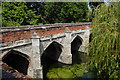


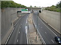
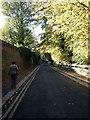
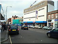
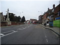

100 photos from this area
Area Information
Key information about the SE9 5QD including its size, population, and administrative classification.
- Area Type
- Postcode
- Area Size
- 8799 m²
- Population
- 1991
- Population Density
- 2085 people/km²
House Prices in SE9 5QD
27
Properties
£251,174
Average Sold Price
£69,000
Lowest Price
£430,000
Highest Price
Showing 27 properties
| Address | Type | Beds | Baths | Last Sale Price | Last Sale Date | |
|---|---|---|---|---|---|---|
| 24, Moat Court, Court Road, Eltham, SE9 5QD | Flat | 2 | 2 | £430,000 | Aug 2025 | |
| 9, Moat Court, Court Road, Eltham, SE9 5QD | Maisonette | 2 | 1 | £391,000 | Jan 2025 | |
| 23, Moat Court, Court Road, Eltham, SE9 5QD | Maisonette | 2 | 1 | £315,000 | Apr 2024 | |
| 6, Moat Court, Court Road, Eltham, SE9 5QD | Maisonette | 2 | 1 | £335,000 | Jan 2024 | |
| 8, Moat Court, Court Road, Eltham, SE9 5QD | Maisonette | - | - | £380,000 | Sep 2023 | |
| 16, Moat Court, Court Road, Eltham, SE9 5QD | Maisonette | 2 | 1 | £325,000 | Mar 2022 | |
| 22, Moat Court, Court Road, Eltham, SE9 5QD | Maisonette | - | - | £310,000 | Oct 2021 | |
| 5, Moat Court, Court Road, Eltham, SE9 5QD | Maisonette | - | - | £280,500 | Jan 2019 | |
| 7, Moat Court, Court Road, Eltham, SE9 5QD | Flat | - | - | £312,000 | Feb 2017 | |
| 4, Moat Court, Court Road, Eltham, SE9 5QD | Maisonette | 2 | 1 | £325,000 | Dec 2016 |
Page 1 of 3
Energy Efficiency in SE9 5QD
Amenities
Schools
| Rank | School | Type | Entry gender | Ages |
|---|
Explore more schools in this area
Go to Schools tabDemographics
Household Size
One person
most common
Accommodation Type
Flats
most common
Tenure
45
majority
Ethnic Group
White
most common
Religion
N/A
most common
Household Composition
N/A
most common
Age
47
median
Adults (30-64 years)
most common
Household Deprivation
N/A
with no deprivation
NS-SEC
41
in Lower managerial occupations
Explore more demographic insights in this area
Go to Demographics tabPlanning
Planning Constraints
- Flood RiskPremium
- Ramsar Wetland SitesPremium
- Area of Outstanding Natural BeautyPremium
- Protected Nature ReservePremium
- Protected WoodlandPremium