Area Overview for SE9 5JF
Photos of SE9 5JF
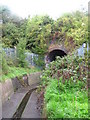

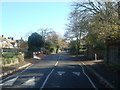
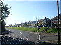
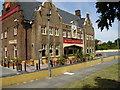
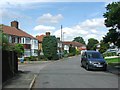
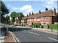
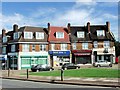
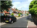
100 photos from this area
Area Information
Key information about the SE9 5JF including its size, population, and administrative classification.
- Area Type
- Postcode
- Area Size
- 8799 m²
- Population
- 1591
- Population Density
- 5979 people/km²
House Prices in SE9 5JF
41
Properties
£241,713
Average Sold Price
£64,995
Lowest Price
£465,000
Highest Price
Showing 41 properties
| Address | Type | Beds | Baths | Last Sale Price | Last Sale Date | |
|---|---|---|---|---|---|---|
| 9 Campfield Road, Eltham, SE9 5JF | Flat | 3 | 1 | £308,000 | Dec 2025 | |
| 37 Campfield Road, Eltham, SE9 5JF | Terraced | 3 | 1 | £465,000 | Mar 2025 | |
| 13 Campfield Road, Eltham, SE9 5JF | Flat | - | - | £320,000 | Jul 2023 | |
| 39 Campfield Road, Eltham, SE9 5JF | house | 3 | 1 | £345,000 | Jun 2022 | |
| 25 Campfield Road, Eltham, SE9 5JF | Terraced | 3 | 1 | £380,000 | Oct 2020 | |
| 23 Campfield Road, Eltham, SE9 5JF | Flat | - | - | £280,000 | Jun 2019 | |
| 31 Campfield Road, Eltham, SE9 5JF | Flat | 2 | - | £215,000 | Mar 2015 | |
| 81 Campfield Road, Eltham, SE9 5JF | Maisonette | 2 | 1 | £210,000 | Jan 2015 | |
| 11 Campfield Road, Eltham, SE9 5JF | Maisonette | 3 | 1 | £225,000 | Dec 2014 | |
| 17 Campfield Road, Eltham, SE9 5JF | Maisonette | 3 | 1 | £160,000 | Aug 2013 |
Page 1 of 5
Energy Efficiency in SE9 5JF
Amenities
Schools
| Rank | School | Type | Entry gender | Ages |
|---|
Explore more schools in this area
Go to Schools tabDemographics
Household Size
Family (3-5 people)
most common
Accommodation Type
Flats
most common
Tenure
32
majority
Ethnic Group
White
most common
Religion
N/A
most common
Household Composition
N/A
most common
Age
47
median
Adults (30-64 years)
most common
Household Deprivation
N/A
with no deprivation
NS-SEC
22
in Lower managerial occupations
Explore more demographic insights in this area
Go to Demographics tabPlanning
Planning Constraints
- Flood RiskPremium
- Ramsar Wetland SitesPremium
- Area of Outstanding Natural BeautyPremium
- Protected Nature ReservePremium
- Protected WoodlandPremium