Area Overview for SE9 5JB
Photos of SE9 5JB

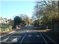
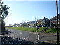
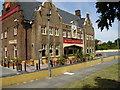
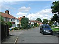
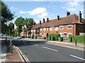
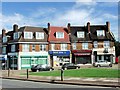
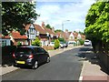
100 photos from this area
Area Information
Key information about the SE9 5JB including its size, population, and administrative classification.
- Area Type
- Postcode
- Area Size
- 8548 m²
- Population
- 1591
- Population Density
- 5979 people/km²
House Prices in SE9 5JB
36
Properties
£216,055
Average Sold Price
£44,000
Lowest Price
£422,000
Highest Price
Showing 36 properties
| Address | Type | Beds | Baths | Last Sale Price | Last Sale Date | |
|---|---|---|---|---|---|---|
| 129 Churchbury Road, Eltham, SE9 5JB | Terraced | 3 | 1 | £422,000 | Dec 2024 | |
| 163 Churchbury Road, Eltham, SE9 5JB | Maisonette | 3 | 1 | £305,000 | Apr 2020 | |
| 169 Churchbury Road, Eltham, SE9 5JB | Maisonette | 3 | 1 | £280,000 | Mar 2017 | |
| 109 Churchbury Road, Eltham, SE9 5JB | Maisonette | - | - | £231,000 | Aug 2015 | |
| 119 Churchbury Road, Eltham, SE9 5JB | Maisonette | - | - | £216,000 | Nov 2014 | |
| 137 Churchbury Road, Eltham, SE9 5JB | Flat | 3 | - | £143,000 | Jun 2011 | |
| 121 Churchbury Road, Eltham, SE9 5JB | Flat | - | - | £168,500 | Sep 2007 | |
| 171 Churchbury Road, Eltham, SE9 5JB | Maisonette | 3 | 1 | £134,995 | Mar 2006 | |
| 115 Churchbury Road, Eltham, SE9 5JB | Flat | - | - | £44,000 | Oct 1997 | |
| 145 Churchbury Road, Eltham, SE9 5JB | Flat | 2 | 1 | - | - |
Page 1 of 4
Energy Efficiency in SE9 5JB
Amenities
Schools
| Rank | School | Type | Entry gender | Ages |
|---|
Explore more schools in this area
Go to Schools tabDemographics
Household Size
Family (3-5 people)
most common
Accommodation Type
Flats
most common
Tenure
32
majority
Ethnic Group
White
most common
Religion
N/A
most common
Household Composition
N/A
most common
Age
47
median
Adults (30-64 years)
most common
Household Deprivation
N/A
with no deprivation
NS-SEC
22
in Lower managerial occupations
Explore more demographic insights in this area
Go to Demographics tabPlanning
Planning Constraints
- Flood RiskPremium
- Ramsar Wetland SitesPremium
- Area of Outstanding Natural BeautyPremium
- Protected Nature ReservePremium
- Protected WoodlandPremium