Area Overview for SE9 5BA
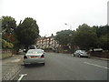
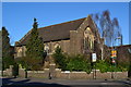
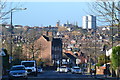
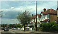
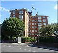
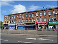
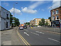
Photos of SE9 5BA

Area Information
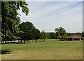
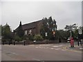
Eltham Town and Avery Hill form the heart of this specific residential cluster, situated within the Royal Borough of Greenwich. This postcode area covers a precise footprint of 4,914 square metres, yet it accommodates a population of 1,753 residents. The density reaches 356,715 people per square kilometre, indicating a tightly knit community rather than a sprawling suburb. You are looking at an estate where human activity dates back to the Mesolithic period, with the modern town documented in the Domesday Book as 'Eald Ham'. Today, the neighbourhood balances urban convenience with open green spaces defined by historical significance. The character here is suburban but retains the identity of an established urban town. Avery Hill Park offers restored heritage features like the Winter Garden and Britain's largest Canary date palm, while nearby Eltham Palace serves as a landmark for many locals. The area extends east towards Avery Hill, approximately 8.7 miles from Charing Cross. You would find yourself in a setting that feels rooted in history, with origins tied to James Boyd's 1841 mansion and later use by overlooks and educational institutions. This is a place where the past informs the daily rhythm of life for those living in this distinct portion of southeast London.
- Area Type
- Postcode
- Area Size
- 4914 m²
- Population
- 1753
- Population Density
- 2399 people/km²
This postcode represents a specific residential cluster where flats dominate the housing stock. With 53% of residents owning their homes, the area offers a significant market for buyers who have achieved mortgage status. The remaining 47% of the population likely rents or shares accommodation, creating a diverse sitting of tenures within this 4,914 square metre site. The prevalence of flats suggests you are looking at efficiency and location over square footage, typical of inner and outer London urban extensions. For buyers considering homes in SE9 5BA, the high ownership rate indicates strong confidence in the local prospects. This is an owner-occupied leaning market where stability often translates to well-maintained buildings. The small size of the area relative to the population density means that properties are likely sought after for their specific integration within the wider Eltham and Avery Hill clusters. When searching for properties, you should focus on the flats available near transport hubs and green spaces. The market here rewards those who understand the value of an urban flat with direct access to the amenities and schools defining the neighbourhood.
House Prices in SE9 5BA
Showing 6 properties
| Address | Type | Beds | Baths | Last Sale Price | Last Sale Date | |
|---|---|---|---|---|---|---|
| 1, Fairway Court, Greenacres, Eltham, SE9 5BA | Flat | - | - | - | - | |
| 5, Fairway Court, Greenacres, Eltham, SE9 5BA | Flat | - | - | - | - | |
| 3, Fairway Court, Greenacres, Eltham, SE9 5BA | Flat | - | - | - | - | |
| 2, Fairway Court, Greenacres, Eltham, SE9 5BA | Flat | - | - | - | - | |
| 6, Fairway Court, Greenacres, Eltham, SE9 5BA | Flat | - | - | - | - | |
| 4, Fairway Court, Greenacres, Eltham, SE9 5BA | Flat | - | - | - | - |
Energy Efficiency in SE9 5BA
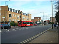
Living in SE9 5BA puts a variety of amenities within practical reach, allowing you to meet daily needs without travelling far. For your shopping requirements, five retail options line up you, including Sainsburys Eltham, Iceland Eltham, and M&S Eltham. These superstores provide comprehensive grocery and household supply chains for residents in the immediate vicinity. Transport connectivity is equally strong, with five rail stations including Eltham, Mottingham Station, and New Eltham forming the primary arteries for commuters. Water transport is also part of the accessible network, featuring five ferry points such as Woolwich Arsenal Pier and Barrier Gardens Pier. For those preferring flexibility, five metro stops like Elverson Road and Cutty Sark for Maritime Greenwich offer alternative routes across London. Furthermore, London City Airport is just one location away, providing short-haul flight access. This dense network of five shops and five transport nodes per category creates a lifestyle where convenience is immediate. You can walk or take a short drive to access these facilities, making the area highly functional for both leisure and daily chores.
Amenities
Schools
Families in this postcode have access to two key educational institutions nearby, each with a clear designation and regulatory standing. St Thomas More Roman Catholic Comprehensive School serves the primary education needs of the community. For secondary education, residents can access St Thomas More Catholic Comprehensive School, which operates as an academy. This institution holds an Ofsted rating of 'good', a designation that signals consistent educational standards and effective school governance. The presence of both primary and academy-style secondary provision allows for a straightforward educational pathway for children growing up in the area. The 'good' rating for the secondary school is a concrete metric that influences many parent choices when selecting homes near SE9 5BA. This mix of school types means you do not need to leave the immediate vicinity for significant portions of a child's education. Both institutions carry the weight of the St Thomas More name, reinforcing a sense of continuity and local identity within the educational landscape.
| Rank | School | Type | Entry gender | Ages |
|---|
Explore more schools in this area
Go to Schools tabDemographics
The community profile for SE9 5BA reveals a mature demographic focused on stability. The median age across the area is 47 years, placing it squarely within the bracket of Adults aged 30 to 64. This indicates a population likely comprised of established families and professionals rather than recent newcomers or empty nesters. Home ownership stands at 53%, suggesting a near-even split between those who have achieved property independence and potential renters or shared ownership households. This balance creates a stable neighbourhood where long-term residents often form the backbone of the street. The predominant ethnic group is White, reflecting the traditional composition of many areas in the Royal Borough of Greenwich. Most residents live in flats, which aligns with the urban, high-density nature of the postcode. This accommodation type supports a lifestyle where proximity to amenities and public transport is prioritised over large private gardens. The age and ownership structure implies a community that values the area for its established character and convenient access to London, making it a practical choice for those seeking a settled environment in the southeast.
Household Size
Accommodation Type
Tenure
Ethnic Group
Religion
Household Composition
Age
Household Deprivation
NS-SEC
Explore more demographic insights in this area
Go to Demographics tabPlanning
Planning Constraints
- Flood RiskPremium
- Ramsar Wetland SitesPremium
- Area of Outstanding Natural BeautyPremium
- Protected Nature ReservePremium
- Protected WoodlandPremium