Area Overview for SE9 5AX
Photos of SE9 5AX
Area Information
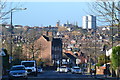
SE9 5AX represents a small residential cluster within the Royal Borough of Greenwich, covering 3,470 square metres. Approximately 1,753 people call this area home, creating a densely packed yet distinct community. The median age here is 47, meaning the population skews significantly towards adults aged between 30 and 64 years. This demographic profile suggests a neighbourhood where established households rather than young families or students dominate. The area sits on the edge of Eltham Town, blending suburban living with urban access. Historically, the wider land around Eltham was recorded as 'Eald Ham' in the Domesday Book, and the nearby Avery Hill Park retains features from the late 19th century, including the restored Winter Garden and Britain's largest Canary date palm. You will find yourself in a location that balances town and country, situated 8.7 miles east-southeast of Charing Cross. The postcode serves as a gateway to the wider Eltham and Avery Hill electoral ward, which saw its first use in the 2022 local elections. Daily life here involves proximity to major transport hubs and historic landmarks like Eltham Palace. While the area is small in physical size, its connection to the broader Royal Borough provides extensive access to services and green spaces.
- Area Type
- Postcode
- Area Size
- 3470 m²
- Population
- 1753
- Population Density
- 2399 people/km²
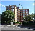
Homes in SE9 5AX exist within a distinct market character defined by high accommodation density. Flats dominate the local housing stock, making this postcode area a focal point for apartment living. With a home ownership rate of 53%, the market is split almost evenly between owners and renters. This balance means buyers have opportunities to purchase freehold properties directly or consider leasehold flats within the local clusters. The area covers only 3,470 square metres, meaning available properties are compact and integrated into a tight neighbourhood. You are looking at a postcode that functions as a pocket community near the larger settlements of Eltham and Avery Hill. The rural history of the wider region, dating back to the Domesday Book, contrasts with the modern flat living found here. Buyers should expect a market that values location and convenience over expansive gardens typical of neighbouring suburban zones. The proximity to the Datre line and Canary Wharf, though not in the immediate postcode, offers a speculative signal of long-term value. Local transactions will likely reflect the small residential nature of the site, with properties selling based on immediate access to transport hubs and nearby retail parks.
House Prices in SE9 5AX
Showing 13 properties
| Address | Type | Beds | Baths | Last Sale Price | Last Sale Date | |
|---|---|---|---|---|---|---|
| 7, Imber Court, Greenacres, Eltham, SE9 5AX | Flat | 2 | 1 | - | - | |
| 13, Imber Court, Greenacres, Eltham, SE9 5AX | Flat | 3 | 1 | - | - | |
| 8, Imber Court, Greenacres, Eltham, SE9 5AX | Flat | 2 | 1 | - | - | |
| 3, Imber Court, Greenacres, Eltham, SE9 5AX | Flat | 2 | 1 | - | - | |
| 5, Imber Court, Greenacres, Eltham, SE9 5AX | Flat | 2 | 1 | - | - | |
| 10, Imber Court, Greenacres, Eltham, SE9 5AX | Flat | - | - | - | - | |
| 6, Imber Court, Greenacres, Eltham, SE9 5AX | Flat | - | - | - | - | |
| 12, Imber Court, Greenacres, Eltham, SE9 5AX | Flat | - | - | - | - | |
| 9, Imber Court, Greenacres, Eltham, SE9 5AX | Flat | - | - | - | - | |
| 11, Imber Court, Greenacres, Eltham, SE9 5AX | Flat | 3 | 1 | - | - |
Energy Efficiency in SE9 5AX
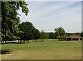
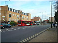
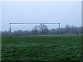
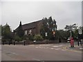
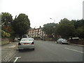
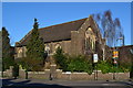
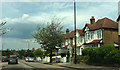
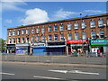
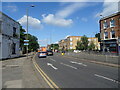
Daily life for residents offers immediate access to essential amenities and leisure spaces. Five retail outlets lie within practical reach, including Sainsburys Eltham, Iceland Eltham, and Lidl Eltham. Supermarkets and convenience stores ensure you can shop for groceries without a long journey. Transport links are equally dense, with rail stations at Eltham and Mottingham Offering flexibility for commuters to The City and south-east London. Five metro stations, including Cutty Sark for Maritime Greenwich, provide further local travel options. Transport and leisure options extend to ferry crossings at Woolwich Arsenal Pier and Barrier Gardens Pier, offering views across the Thames. London City Airport lies nearby, providing direct international connections. Outside, Avery Hill Park offers a significant green space with the Tudor Conduit and Henley's Field. The restored Winter Garden features Britain's largest Canary date palm, providing a unique local landmark. Eltham Palace stands as a key heritage site within the wider ward. This mix of historic landmarks, modern retail, and extensive transport links creates a convenient lifestyle. You can enjoy nature in the park or shop in town, all within a small residential footprint.
Amenities
Schools
Families in SE9 5AX benefit from two named educational institutions located nearby. St Thomas More Roman Catholic Comprehensive School operates as a primary school for younger pupils. Further up the academic chain, St Thomas More Catholic Comprehensive School serves as an academy for older children. This academy holds a good Ofsted rating, which indicates a standard of education accepted by regulators and parents alike. The presence of a Catholic comprehensive school suggests a community with specific faith-based educational options available within close reach. For younger children, the primary option remains within the immediate vicinity, reducing travel time for drop-offs and pick-ups. The dual presence of primary and secondary options on the same name, though potentially separate entities, simplifies the search for families staying in the Ward. You do not need to look beyond the local district to find schools affiliated with the St Thomas More network. This concentration of educational facilities supports families who prioritise local schooling over commuting to larger complexes in other boroughs.
| Rank | School | Type | Entry gender | Ages |
|---|
Explore more schools in this area
Go to Schools tabDemographics
The community in SE9 5AX is defined by a stable residential population. The most common age range comprises adults between 30 and 64 years old, with a median age of 47. This indicates a settled community rather than a transient one. Home ownership stands at 53%, suggesting that more than half of the residents own their homes outright or with a mortgage. The remaining population consists of tenants or shared owners. Flats form the predominant type of accommodation in this specific postcode cluster, reflecting the urban density of the site. The area is predominantly white in terms of predominant ethnicity. With a population density of 505,126 people per square kilometre, the local environment is compact. This high density is consistent with the nature of the site as a small residential cluster. The demographic mix supports a mature lifestyle, where residents likely rely on established local amenities rather than developments catering to children or young professionals. The 53% ownership rate implies a mix of long-term families and older residents who have secured their properties over time.
Household Size
Accommodation Type
Tenure
Ethnic Group
Religion
Household Composition
Age
Household Deprivation
NS-SEC
Explore more demographic insights in this area
Go to Demographics tabPlanning
Planning Constraints
- Flood RiskPremium
- Ramsar Wetland SitesPremium
- Area of Outstanding Natural BeautyPremium
- Protected Nature ReservePremium
- Protected WoodlandPremium