Area Overview for SE9 4ZA
Photos of SE9 4ZA


Area Information
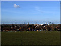
SE9 4ZA represents a specific residential cluster within the greater London postcode district. This small area typically houses around 1,600 residents, creating a tight-knit community rather than a sprawling suburb. Living here means operating within a defined postcode zone that serves as a bridge between local residential streets and wider transport arteries. The area functions as a quiet pocket of housing, distinct from the larger settlements of Eltham or Mottingham that also serve the region. Your daily life in SE9 4ZA will be shaped by proximity to key travel hubs, including Mottingham Station, New Eltham, and Eltham, all within practical reach. The postcode area offers a straightforward living environment without the complexity of mixed-use planning zones. You will find yourself in a zone characterised by its low population density and residential focus. There are no large commercial developments or industrial sites immediately embedded within this specific cluster. Instead, the local character is defined by its function as a sleeping base for commuters and local families. The area provides a stable setting where the primary activity remains the home. This makes SE9 4ZA suitable for those who prioritise a residential feel above all other factors.
- Area Type
- Postcode
- Area Size
- Not available
- Population
- 1609
- Population Density
- 3459 people/km²
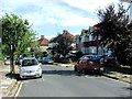
The housing market in SE9 4ZA is overwhelmingly owner-occupied, with 80 per cent of homes owned outright or with a mortgage. Only 20 per cent of households rely on the rental sector, making this a distinct choice for those seeking to purchase rather than rent. Accommodation consists almost entirely of houses, meaning you will not find flats or purpose-built blocks within this specific postcode. This preference for houses gives the area a suburban character, even when located near major transport links. The local stock likely includes semi-detached and terraced properties typical of South East London growth areas. For buyers looking at homes in SE9 4ZA, the investment horizon is generally long-term, as most owners stay put for years. The market does not cater to the fast-paced turnover often seen in high-rise rental districts. New buyers will find they are entering a mature market where properties are traded between owners seeking to move or retirees selling up. The lack of rental properties implies limited flats for sale, focusing the market on houses of varying sizes. This structure ensures that the area retains its residential exclusivity and avoids the transient feel of shared housing estates.
House Prices in SE9 4ZA
No properties found in this postcode.
Energy Efficiency in SE9 4ZA
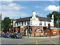
Your lifestyle in SE9 4ZA is defined by the close proximity of essential amenities and leisure facilities. Within practical reach, you will find five retail locations, including M&S Mottingham BP, Lidl LON, and Tesco Eltham, ensuring your daily shopping needs are met without long journeys. Five park and ride sites, such as Elverson Road, provide convenient parking solutions for commuters coming from further afield if you choose to visit nearby hubs. Cultural and leisure opportunities include the famous Cutty Sark for Maritime Greenwich and Cutty Sark DLR Station, offering easy access to history and dining. You also have five ferry terminals accessible, including Barrier Gardens Pier and Woolwich Ferry North Pier, allowing you to explore Woolwich or the Isle of Dogs with ease. The presence of London City Airport means you can travel abroad with minimal hassle from your doorstep. These amenities create a neighbourhood that feels connected to the wider city without sacrificing local convenience. Retail choices cover your basics, while cultural sites add depth to your weekends. Living in SE9 4ZA offers a balance where you have a local home but city-wide facilities just outside your yard gate.
Amenities
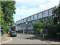
Schools
| Rank | School | Type | Entry gender | Ages |
|---|
Explore more schools in this area
Go to Schools tabDemographics
The community in SE9 4ZA is dominated by adults aged between 30 and 64 years. This age range represents the most common demographic, indicating that the area attracts established households rather than students or young singles. The median age of residents is 47 years, which aligns closely with the profile of a settled neighbourhood. Home ownership stands at an impressive 80 per cent, showing that the vast majority of households buy rather than rent. This high level of ownership suggests long-term residents who are invested in the local stability of SE9 4ZA. Houses form the predominant accommodation type, reflecting a preference for standalone living spaces or semi-detached homes. The people living here are largely of White ethnicity, mirroring the broader trends seen in similar South East London postcodes. There is no significant population of children under 15 or households with dependent children recorded in the available figures. The demographic profile points to a quiet, mature environment. Living in SE9 4ZA means surrounding yourself with neighbours who are likely to be retired or in established mid-life stages. The area does not cater to a young professional demographic seeking urban vibrancy. Instead, it offers a settled environment tailored to families and those prioritising stability over novelty.
Household Size
Accommodation Type
Tenure
Ethnic Group
Religion
Household Composition
Age
Household Deprivation
NS-SEC
Explore more demographic insights in this area
Go to Demographics tabPlanning
Planning Constraints
- Flood RiskPremium
- Ramsar Wetland SitesPremium
- Area of Outstanding Natural BeautyPremium
- Protected Nature ReservePremium
- Protected WoodlandPremium