Area Overview for SE9 4SP
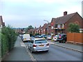
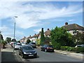
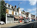
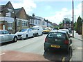
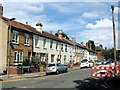
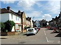
Photos of SE9 4SP


Area Information
Living in SE9 4SP means inhabiting a very specific postcode area covering a small residential cluster of just 1338 square metres. You are part of a tiny population of 1612 people, which gives the location a distinct intensity. The population density here reaches an extreme 1204928 people per square kilometre, a figure that highlights how compact and tightly packed this housing space is. This is not an open or sprawling neighbourhood; it is a concentrated residential zone where indoor and outdoor boundaries can feel close together. You become part of a community where every home is in near proximity to its neighbours, creating a unique living rhythm defined by density rather than spaciousness. Daily life in SE9 4SP involves navigating a confined footprint while enjoying the benefits of being embedded in a larger suburban context. The area serves as a focused slice of South East London, offering a home that is strictly defined by its postal address yet connected to broader transport networks. The sheer concentration of residents in such a limited surface area makes this postcode a specialised choice for those seeking a specific, compact location. It is a place where you know precisely where you live, bounded by strict geographical limits within the wider SE9 stretch.
- Area Type
- Postcode
- Area Size
- 1338 m²
- Population
- 1612
- Population Density
- 7673 people/km²
The property market in SE9 4SP is characterised by a limited supply of houses within a tiny postcode footprint of 1338 square metres. With 58% of the accommodation being owner-occupied, the area functions primarily as an established owner-occupied zone rather than a rental-heavy hub. The predominant accommodation type is houses, which informs the buying pool for those looking at this specific cluster. Homes in SE9 4SP cater largely to individuals or families who have secured ownership of a freehold or leasehold property. This high ownership ratio means you may find fewer new build rentals but more potential for purchasing existing stock from current owners who have likely lived there for years. You are competing with a local market where sellers are often looking to move from this dense residential spot, perhaps due to space constraints given the extremely low surface area. The market here reflects a buyer market for those willing to navigate the specific limitations of the SE9 4SP postcode. For someone seeking a house in this specific cluster, the transaction process involves standard conveyancing but within a very small and defined geographic boundary.
House Prices in SE9 4SP
Showing 5 properties
| Address | Type | Beds | Baths | Last Sale Price | Last Sale Date | |
|---|---|---|---|---|---|---|
| 150 Mottingham Road, Mottingham, London, SE9 4SP | Semi-detached | 3 | 1 | £360,000 | Dec 2015 | |
| 152 Mottingham Road, Mottingham, London, SE9 4SP | Semi-detached | 3 | - | - | - | |
| Second Floor Flat, Prince Of Wales, 154 Mottingham Road, Mottingham, London, SE9 4SP | Flat | - | - | - | - | |
| First Floor Flat, Prince Of Wales, 154 Mottingham Road, Mottingham, London, SE9 4SP | Flat | - | - | - | - | |
| Prince Of Wales, 154 Mottingham Road, Mottingham, London, SE9 4SP | restaurant_cafe | - | - | - | - |
Energy Efficiency in SE9 4SP
Your daily life in SE9 4SP benefits from practical access to retail, rail, and metro links within easy reach. For shopping needs, Lidl LON, M&S Mottingham BP, and Co-op Mottingham serve as your primary retail destinations nearby. These supermarkets and high street essentials ensure you can handle daily provisions without leaving the immediate commuter zone. Transport options are extensive, with rail connections via Mottingham Station, New Eltham, and Elmstead Woods providing efficient routes outwards. You also have metro access through stations like Elverson Road, Deptford Bridge, and Cutty Sark for Maritime Greenwich, linking you to central London and the east. For those preferring water-based travel, Greenwich Pier, Barrier Gardens Pier, and Woolwich Ferry North Pier offer ferry services across the river. London City Airport is the designated airport nearby, convenient for early morning flights. This mix of retail and transport means you can shop for groceries, catch a train, or fly domestically all within a short journey from your home in SE9 4SP. The variety of options ensures that your daily convenience is never far away.
Amenities
Schools
| Rank | School | Type | Entry gender | Ages |
|---|
Explore more schools in this area
Go to Schools tabDemographics
The community in SE9 4SP is shaped by a mature demographic profile, with a median age of 47 years. The most common age range for residents consists of adults aged between 30 and 64 years, indicating that households here tend to be middle-aged families or established singles. Around 58% of homes in this postcode are owner-occupied, showing that the majority of the population has purchased their property rather than renting. The prevailing accommodation type is houses, which suggests a suburban character despite the high local density. The predominant ethnic group in this area is White, reflecting a specific cultural makeup for this cluster of homes. You are living alongside a community defined by stability and purchase, as nearly six out of every ten residents own their dwelling. This homeownership level contrasts with younger, high-rent urban districts and points toward a settled neighbourhood. The age structure implies a quiet period for nightlife, with the bulk of the population having retired or established careers long ago. The demographic makeup creates a predictable social environment where long-term residents form the backbone of daily interaction.
Household Size
Accommodation Type
Tenure
Ethnic Group
Religion
Household Composition
Age
Household Deprivation
NS-SEC
Explore more demographic insights in this area
Go to Demographics tabPlanning
Planning Constraints
- Flood RiskPremium
- Ramsar Wetland SitesPremium
- Area of Outstanding Natural BeautyPremium
- Protected Nature ReservePremium
- Protected WoodlandPremium