Area Overview for SE9 4RX
Photos of SE9 4RX

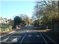
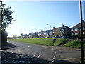

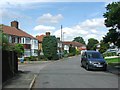
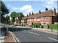
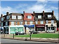
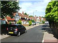
100 photos from this area
Area Information
Key information about the SE9 4RX including its size, population, and administrative classification.
- Area Type
- Postcode
- Area Size
- 3.8 hectares
- Population
- 1400
- Population Density
- 1206 people/km²
House Prices in SE9 4RX
13
Properties
£729,719
Average Sold Price
£240,000
Lowest Price
£1,395,000
Highest Price
Showing 13 properties
| Address | Type | Beds | Baths | Last Sale Price | Last Sale Date | |
|---|---|---|---|---|---|---|
| Greet, Mottingham Lane, Mottingham, London, SE9 4RX | house | 4 | 2 | £1,395,000 | Oct 2024 | |
| Droskyn, Mottingham Lane, Mottingham, London, SE9 4RX | Semi-detached | 3 | - | £509,000 | May 2020 | |
| The Croft, Mottingham Lane, Mottingham, London, SE9 4RX | Detached | 5 | 1 | £785,000 | Jul 2019 | |
| Five Witches, Mottingham Lane, Mottingham, London, SE9 4RX | Detached | 4 | 3 | £915,000 | Jan 2018 | |
| Badgers Mount, Mottingham Lane, Mottingham, London, SE9 4RX | Detached | 5 | - | £1,093,750 | Jun 2013 | |
| Oakwood, Mottingham Lane, Mottingham, London, SE9 4RX | Bungalow | 3 | - | £550,000 | Mar 2012 | |
| Treetops, Mottingham Lane, Mottingham, London, SE9 4RX | house | - | - | £350,000 | Jul 2011 | |
| Keruing, Mottingham Lane, Mottingham, London, SE9 4RX | house | - | - | £240,000 | May 1995 | |
| Cerises, Mottingham Lane, Mottingham, London, SE9 4RX | Detached | - | - | - | - | |
| The Copse, Mottingham Lane, Mottingham, London, SE9 4RX | Detached | - | - | - | - |
Page 1 of 2
Energy Efficiency in SE9 4RX
Amenities
Schools
| Rank | School | Type | Entry gender | Ages |
|---|
Explore more schools in this area
Go to Schools tabDemographics
Household Size
Two person
most common
Accommodation Type
Houses
most common
Tenure
69
majority
Ethnic Group
White
most common
Religion
N/A
most common
Household Composition
N/A
most common
Age
47
median
Adults (30-64 years)
most common
Household Deprivation
N/A
with no deprivation
NS-SEC
44
in Lower managerial occupations
Explore more demographic insights in this area
Go to Demographics tabPlanning
Planning Constraints
- Flood RiskPremium
- Ramsar Wetland SitesPremium
- Area of Outstanding Natural BeautyPremium
- Protected Nature ReservePremium
- Protected WoodlandPremium