Area Overview for SE9 4QH
Photos of SE9 4QH

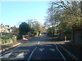
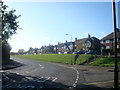
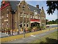
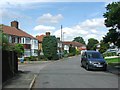
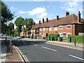
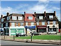
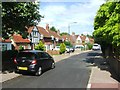
100 photos from this area
Area Information
Key information about the SE9 4QH including its size, population, and administrative classification.
- Area Type
- Postcode
- Area Size
- 8128 m²
- Population
- 1400
- Population Density
- 1206 people/km²
House Prices in SE9 4QH
22
Properties
£372,222
Average Sold Price
£120,000
Lowest Price
£620,000
Highest Price
Showing 22 properties
| Address | Type | Beds | Baths | Last Sale Price | Last Sale Date | |
|---|---|---|---|---|---|---|
| 25 Highcombe Close, Mottingham, London, SE9 4QH | house | - | - | £595,000 | Aug 2025 | |
| 11 Highcombe Close, Mottingham, London, SE9 4QH | Semi-detached | 3 | - | £620,000 | Jul 2022 | |
| 23 Highcombe Close, Mottingham, London, SE9 4QH | Semi-detached | 3 | 2 | £537,500 | Mar 2017 | |
| 33 Highcombe Close, Mottingham, London, SE9 4QH | Semi-detached | 3 | - | £380,000 | Dec 2015 | |
| 39 Highcombe Close, Mottingham, London, SE9 4QH | Semi-detached | 3 | 2 | £330,000 | Oct 2013 | |
| 13 Highcombe Close, Mottingham, London, SE9 4QH | Semi-detached | 3 | 1 | £267,500 | Nov 2012 | |
| 7 Highcombe Close, Mottingham, London, SE9 4QH | Semi-detached | - | - | £250,000 | Jun 2008 | |
| 9 Highcombe Close, Mottingham, London, SE9 4QH | Semi-detached | - | - | £250,000 | Dec 2004 | |
| 15 Highcombe Close, Mottingham, London, SE9 4QH | Semi-detached | - | - | £120,000 | Mar 1998 | |
| 41 Highcombe Close, Mottingham, London, SE9 4QH | Detached | 3 | 1 | - | - |
Page 1 of 3
Energy Efficiency in SE9 4QH
Amenities
Schools
| Rank | School | Type | Entry gender | Ages |
|---|
Explore more schools in this area
Go to Schools tabDemographics
Household Size
Two person
most common
Accommodation Type
Houses
most common
Tenure
69
majority
Ethnic Group
White
most common
Religion
N/A
most common
Household Composition
N/A
most common
Age
47
median
Adults (30-64 years)
most common
Household Deprivation
N/A
with no deprivation
NS-SEC
44
in Lower managerial occupations
Explore more demographic insights in this area
Go to Demographics tabPlanning
Planning Constraints
- Flood RiskPremium
- Ramsar Wetland SitesPremium
- Area of Outstanding Natural BeautyPremium
- Protected Nature ReservePremium
- Protected WoodlandPremium