Area Overview for SE9 4QF
Photos of SE9 4QF
Area Information
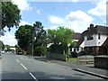
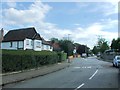
SE9 4QF is a compact residential cluster covering just 2.9 hectares within the SE9 postcode area. It accommodates roughly 1,400 residents, resulting in a population density of 1,206 people per square kilometre. This specific location offers a tight-knit environment where residents live close to immediate neighbours. For those considering living in SE9 4QF, the small footprint means you will experience a quiet, neighbourhood-focused lifestyle. The area is firmly established as a housing cluster rather than a broader district. You will find that daily life here revolves around proximity and convenience. The local community is well-defined, making it easy to identify local services and friends quickly. This postcode represents a specific residential slice of south-east London where space is at a premium relative to the number of homes. Potential buyers should note that the area is designed for practical living in a confined zone. The character of SE9 4QF is shaped by its limited size, creating an intimate setting for its 1,400 inhabitants.
- Area Type
- Postcode
- Area Size
- 2.9 hectares
- Population
- 1400
- Population Density
- 1206 people/km²
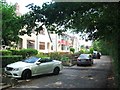
You will find that homes in SE9 4QF are primarily situated within the house stock rather than multi-unit residential blocks. The accommodation type data confirms that houses dominate the local landscape. This structure aligns with the high home ownership rate of 69%, indicating a market driven by buyers who have purchased rather than tenants. The property market here reflects a tradition of single-family or detached living. For those looking to buy, the prevalence of houses suggests limited availability of flats or apartments within the immediate cluster. The small area size of 2.9 hectares further constrains the development of large-scale housing projects. Ownership is the norm, which often implies stable, long-term residents looking to maintain or enhance their properties. This market profile is typical of a mature residential zone where land value remains high due to scarcity. If you are considering purchasing, expect houses to command a premium consistent with their scarcity and the strong demand from owner-occupiers.
House Prices in SE9 4QF
Showing 4 properties
| Address | Type | Beds | Baths | Last Sale Price | Last Sale Date | |
|---|---|---|---|---|---|---|
| Bursars House, Eltham College, Mottingham Lane, Mottingham, London, SE9 4QF | Detached | - | - | - | - | |
| Westfield Eltham College, Grove Park Road, Mottingham, London, SE9 4QF | Flat | - | - | - | - | |
| Headmasters House, Eltham College, Grove Park Road, Mottingham, London, SE9 4QF | Detached | - | - | - | - | |
| School Keepers House, Eltham College, Grove Park Road, Mottingham, London, SE9 4QF | Semi-detached | 3 | 1 | - | - |
Energy Efficiency in SE9 4QF
Amenities
Schools
Families considering schools near SE9 4QF have access to a variety of educational institutions within practical reach. Dorset Road Infant School operates as a primary academy providing early years education for local children. Eltham College serves as a prominent independent school option for families seeking private education. Another Dorset Road Infant School entry notes its status as a primary institution within the area's educational network. This mix of academy, independent, and primary options gives parents flexibility in choosing an educational path. You will not find secondary schools listed in the immediate proximity data, so further research is usually required for older children. The presence of Eltham College indicates access to high-standard private education for those who can afford it. Dorset Road Infant School offers state-funded primary education alongside the independent sector. The variety of school types means the area caters to different educational philosophies and budgets. Parents benefit from having multiple primary choices in the vicinity without needing to travel significantly far from SE9 4QF.
| Rank | School | Type | Entry gender | Ages |
|---|
Explore more schools in this area
Go to Schools tabDemographics
The community in SE9 4QF features a mature population with a median age of 47 years. The majority of residents fall into the adults' bracket spanning 30 to 64 years old. This age profile suggests the area is primarily suited to established households, those retiring, or families with older children. Home ownership stands at 69%, meaning nearly seven out of ten residents own their property outright. Consequently, the local market is dominated by owner-occupied dwellings rather than rented flats. Houses constitute the predominant form of accommodation, reflecting the preferences of the long-term residents. The demographic data indicates a stable community where investment and permanence are common themes. While the predominant ethnic group is White, the high ownership rate suggests a settled population structure. Living in this demographic environment means you are surrounded by neighbours who are likely deeply rooted in the locality. This stability can offer a quiet, predictable atmosphere for those seeking to establish a permanent home base.
Household Size
Accommodation Type
Tenure
Ethnic Group
Religion
Household Composition
Age
Household Deprivation
NS-SEC
Explore more demographic insights in this area
Go to Demographics tabPlanning
Planning Constraints
- Flood RiskPremium
- Ramsar Wetland SitesPremium
- Area of Outstanding Natural BeautyPremium
- Protected Nature ReservePremium
- Protected WoodlandPremium