Area Overview for SE9 4LQ
Photos of SE9 4LQ


Area Information
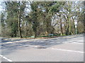
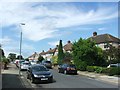
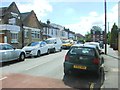
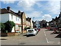
The SE9 4LQ postcode represents a specific residential cluster in South East London, home to a population of 1,572 people. This small area serves as a quiet corner within the broader Mottingham neighbourhood, offering a contained community feel suitable for those seeking a more secluded address while remaining close to larger towns. Life here revolves around a mix of stability and accessibility, where residents enjoy proximity to Greenwich and other key urban centres without being overwhelmed by city traffic. The location offers a practical balance for commuters, with rail and tram options ensuring you can reach London efficiently. You are situated near key transport hubs including Mottingham Station and New Eltham, placing you at the heart of a connected network. Daily living involves easy access to local convenience stores and leisure spots, such as the parks found nearby at Barrier Gardens. While the immediate vicinity is intimate, the wider network of transport links means you are never truly isolated. Living in SE9 4LQ provides a foundation for a grounded existence, where the small-scale population fosters a sense of familiarity yet the transport infrastructure keeps you firmly plugged into the wider London market.
- Area Type
- Postcode
- Area Size
- Not available
- Population
- 1572
- Population Density
- 9134 people/km²
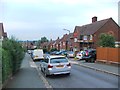
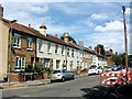
Homes in SE9 4LQ are defined by a clear property type: houses dominate the local housing stock. This accommodation type contrasts with the tall blocks found in central London, offering more land and typically larger internal spaces. With a home ownership rate of 42%, the market here leans significantly towards owner-occupiers rather than a high-rental sector. This dynamic often means properties are bought and sold with long-term intentions in mind, potentially reducing speculative flipping in the very short term. Buyers looking at this post code should expect a traditional British suburban setting where gardens and driveways are common features. The concentration of houses implies that noise levels from neighbors may differ from apartment blocks, often resulting in a quieter domestic environment. You might find that properties in this area are suited to families or individuals seeking a yard rather than a balcony. The mix of ownership suggests a competitive but grounded market where sellers have established local ties. Whether you are viewing a bungalow or a two-storey family home, the emphasis is on residential space and distinct address identity within the SE9 zone.
House Prices in SE9 4LQ
No properties found in this postcode.
Energy Efficiency in SE9 4LQ
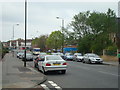
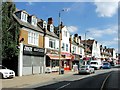
Lifestyle in SE9 4LQ centres on local convenience with access to a variety of retail and transport options. Residents find five retail venues within practical reach, including the Co-op Mottingham, Lidl LON, and the M&S Mottingham BP at the nearby service station. These shops provide daily essentials and groceries without the need for a long journey into central London. Transport links are extensive, with five rail stations nearby including Mottingham Station, Elmstead Woods, and New Eltham. Additionally, five metro stops such as Elverson Road and Beckenham Road Tram Stop offer flexible journey options across the network. For those who prefer water travel, five ferry terminals are accessible, including Greenwich Pier, Barrier Gardens Pier, and Woolwich Arsenal Pier. London City Airport is just one airport away, making business travel manageable. This density of facilities means you can manage your weekly shopping and commuting needs locally. You also have leisure options nearby, such as the barrier gardens for outdoor relaxation. The variety of transport modes ensures you can choose the method that suits your mood or schedule best. Living in SE9 4LQ offers a lifestyle where local amenities and connectivity coexist without overwhelming the residential peace.
Amenities
Schools
Families considering SE9 4LQ have access to two specific primary schools within the immediate locality. Mottingham Primary School stands as one option for younger children, providing education for the early years of schooling. Nearby, Ravensworth Primary School holds a Good Ofsted rating, confirming its status as a reliable educational establishment according to government inspections. Both institutions are primary level, meaning direct proximity to secondary schools is not immediately evident from this specific data set. For parents prioritising education, the presence of a rated Good school like Ravensworth offers a strong starting point for your child's academic journey. The availability of these two named schools simplifies the decision-making process for those working within the borough boundaries. While the range is limited to primary provision in the listed data, the location generally feeds into the broader Merseywood or South East Kent Academy systems common to the area. You can rely on these specific ratings and names when planning your route to school or assessing the local education landscape. The school options support the area's demographic of working-age adults who require stable, local facilities for raising children.
| Rank | School | Type | Entry gender | Ages |
|---|
Explore more schools in this area
Go to Schools tabDemographics
The community in SE9 4LQ reflects a mature demographic profile, aligning closely with the needs of established households. The median age for residents is 47 years, confirming that adults between 30 and 64 years old form the most common age range. This population structure suggests a neighbourhood where families with older children or empty nesters often settle. Home ownership stands at 42%, indicating that nearly half of the residents own their homes outright or with a mortgage. The remaining residents likely rent, contributing to a mixture of tenures within this small pocket of London. The majority of dwellings are houses, creating an environment characterised by detached or semi-detached properties rather than high-rise flats. This housing stock supports a demographic that values space and privacy over urban density. White residents constitute the predominant ethnic group in the area, reflecting the traditional social makeup of many South East London suburbs. Understanding these figures helps you grasp the likely neighbours and the prevailing cultural tone of the street. The high proportion of homeowners suggests a community focused on long-term stability rather than transient living.
Household Size
Accommodation Type
Tenure
Ethnic Group
Religion
Household Composition
Age
Household Deprivation
NS-SEC
Explore more demographic insights in this area
Go to Demographics tabPlanning
Planning Constraints
- Flood RiskPremium
- Ramsar Wetland SitesPremium
- Area of Outstanding Natural BeautyPremium
- Protected Nature ReservePremium
- Protected WoodlandPremium