Area Overview for SE9 4HS
Photos of SE9 4HS
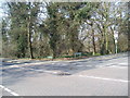

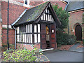


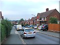
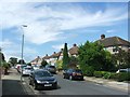

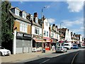

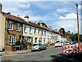
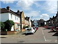
51 photos from this area
Area Information
Key information about the SE9 4HS including its size, population, and administrative classification.
- Area Type
- Postcode
- Area Size
- 6615 m²
- Population
- 1545
- Population Density
- 5450 people/km²
House Prices in SE9 4HS
24
Properties
£287,231
Average Sold Price
£55,000
Lowest Price
£450,000
Highest Price
Showing 24 properties
| Address | Type | Beds | Baths | Last Sale Price | Last Sale Date | |
|---|---|---|---|---|---|---|
| 168 Dunkery Road, Mottingham, London, SE9 4HS | Terraced | 3 | 1 | £390,000 | Jun 2024 | |
| 174 Dunkery Road, Mottingham, London, SE9 4HS | Terraced | 2 | 1 | £345,000 | Nov 2023 | |
| 148 Dunkery Road, Mottingham, London, SE9 4HS | Terraced | 2 | 1 | £295,000 | Oct 2023 | |
| 130 Dunkery Road, Mottingham, London, SE9 4HS | Terraced | 3 | 1 | £450,000 | Feb 2023 | |
| 146 Dunkery Road, Mottingham, London, SE9 4HS | Terraced | 2 | 1 | £340,000 | May 2021 | |
| 140 Dunkery Road, Mottingham, London, SE9 4HS | Semi-detached | 3 | 1 | £433,500 | Feb 2021 | |
| 170 Dunkery Road, Mottingham, London, SE9 4HS | house | - | - | £337,000 | Aug 2018 | |
| 132 Dunkery Road, Mottingham, London, SE9 4HS | Terraced | 2 | 1 | £322,500 | May 2018 | |
| 172 Dunkery Road, Mottingham, London, SE9 4HS | Terraced | 2 | - | £266,000 | Nov 2014 | |
| 160 Dunkery Road, Mottingham, London, SE9 4HS | house | - | - | £175,000 | Sep 2006 |
Page 1 of 3
Energy Efficiency in SE9 4HS
Amenities
Schools
| Rank | School | Type | Entry gender | Ages |
|---|
Explore more schools in this area
Go to Schools tabDemographics
Household Size
Family (3-5 people)
most common
Accommodation Type
Houses
most common
Tenure
37
majority
Ethnic Group
White
most common
Religion
N/A
most common
Household Composition
N/A
most common
Age
47
median
Adults (30-64 years)
most common
Household Deprivation
N/A
with no deprivation
NS-SEC
23
in Lower managerial occupations
Explore more demographic insights in this area
Go to Demographics tabPlanning
Planning Constraints
- Flood RiskPremium
- Ramsar Wetland SitesPremium
- Area of Outstanding Natural BeautyPremium
- Protected Nature ReservePremium
- Protected WoodlandPremium